A new set of maps, posters, and architectural plans from our partner, the Durham County Library, has been added to our site. They range in time from the late 1880s to the present, and many provide local insight to the culture of Durham.
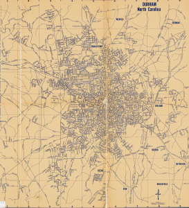
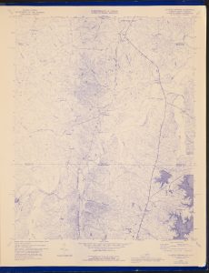
Map of Durham, N.C., c. 1957
One of the most exciting maps that we’ve added is this mid-century Western States Publishing Co. Map—perhaps one of the last versions that documents Durham before I-85 (1958) and N.C. 147 highway were built (1967-1970). Comparing it to the city today, you can tell what was disrupted during construction.
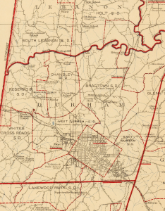
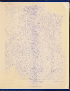
Detail from the 1920 map of Durham County
Similarly, this map of Durham from 1920 notes the schools in the area and whether they served Black or White students. According to this map, many of the schools closest to the city center only served White students, while many of the Black schools are further out in the county.
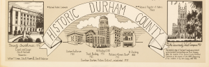
Another neat item in this batch is this Historic Durham County Poster created by John B. Tomlinson. Around the drawn map of Durham County are illustrations of some of Durham’s famous and historic landmarks, including Duke University’s West Campus, NC Central University, and the County Courthouse. These and other annotations help identify some of the big moments in Durham’s history, such as the surrender of J.E. Johnston at Bennett Place.
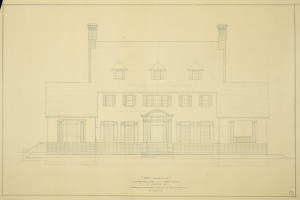
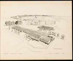
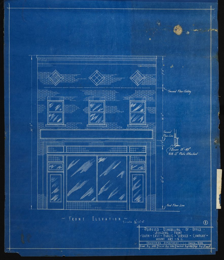
House for Mrs. L.L. Morehead (c. 1900)
Another item that illuminates a part of Durham’s history is this set of architectural plans for the house of Mrs. L.L. Morehead. The house was built for Eugene Morehead, son of former North Carolina Governor John Motley Morehead, and Eugene’s wife, Lucy Lathrop Morehead. The house was torn down in 1961, but photos and illustrations of the final product are still around. Other building plans for the house, including some of the interior, were also uploaded in this batch.
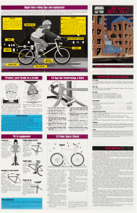
1991 Bike Map
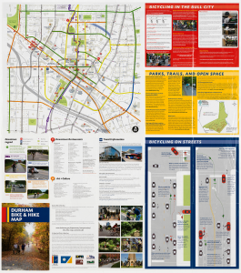
2010 Bike Map
In terms of more modern materials, take a look at these two bike maps: one from 1991, and one from 2010. The entire back side of the 1991 version is covered in safety information, like how to wear a helmet and 10 tips for “frustrating” a bike thief (No.8 is to “Engrave your social security number on expensive parts,” which doesn’t seem like common advice today.). Meanwhile, the back of the 2010 map is more like a typical city map, with directories of things in downtown Durham.
One bonus of these maps is that they are catalogued and finable through the Durham Public Library’s website. You can see all the maps we digitized in this batch here, and you can see all materials from Durham County Library here. For more information about the library and their holdings, visit their website.