DigitalNC is happy to welcome a new partner– the Anson County Historical Society!
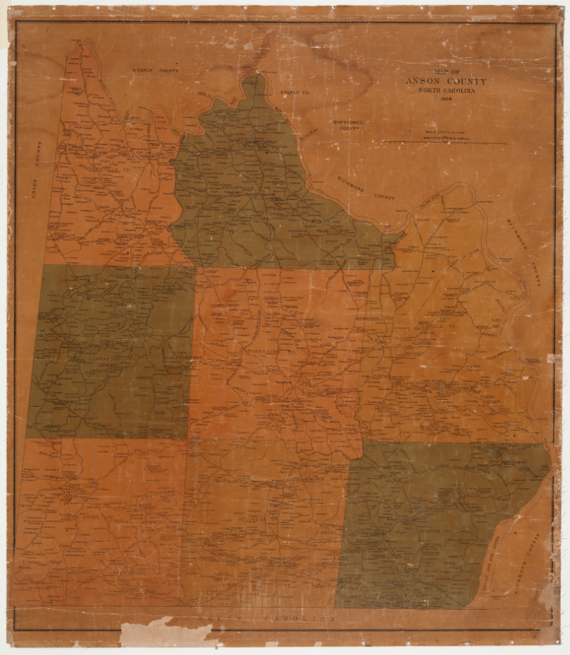
The Anson County Historical society is an organization devoted to providing access to Anson County’s rich history through educational, cultural, and recreational resources. This includes the preservation of physical items, like this map from 1904. An excellent resource for genealogists or local historians, this map documents family names and property locations in addition the other intricate details, like schools, cemeteries, businesses, railroads, and homesteads. Maps with this much detail are rare and serve as excellent research tools.
For more information about the Anson County Historical Society, please visit the contributor page or the website. For maps of North Carolina on DigitalNC, please search the Images of North Carolina Collection and limit by “maps.”