Primary Source Set
Analyzing Maps
One of the ways people understand space and geography is through the creation of maps. A tool used to document locations, maps began to be used by more and more people after the invention of the printing press in the 15th century. This primary source set provides examples of North Carolina maps from three centuries to show how the state and its geographic documentation practices have evolved throughout history.
Time Period
18th-21st Centuries
Grade Level
3 – 6
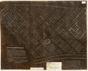
1799 Haywood Map [1908, 1799]
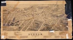
Bird's Eye View of the City of Durham, N.C. (1891)
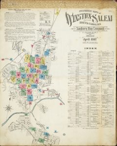
Sanborn Insurance Maps of Winston-Salem, North Carolina (1907)
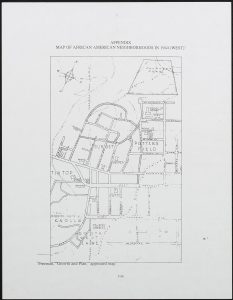
Map of African-American Neighborhoods in Chapel Hill [1944]
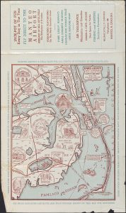
Manteo Airport Brochure [circa 1959]
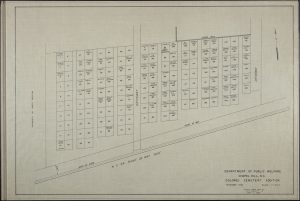
Department of Public Welfare Chapel Hill, NC Colored Cemetary Addition [1960]
A Map of Gastonia dating back to 1895 [1972]
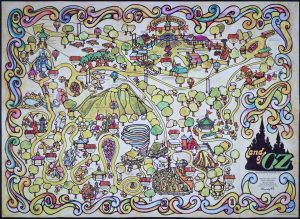
Land of Oz Map (1975)
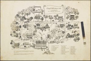
Chapel Hill in 1818 as remembered by W.D. Moseley (1976)
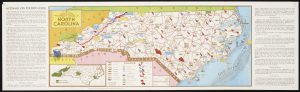
An Outdoor and Tourist Guide to North Carolina
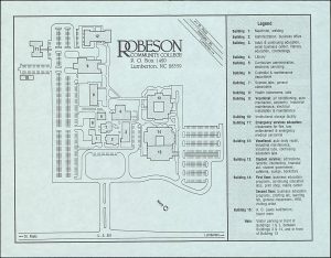
Robeson Community College Building Map [2002]
Background
With the invention of the printing press in the 15th century, maps became a popular tool for documenting geography and understanding the world. The first maps of North Carolina during this time were by sailors using maps to record information about the North Carolina coast. Some of the earliest maps focus on British settlements around Cape Fear and the surrounding Native American communities. The maps you will see here are influenced by European cartography (or mapmaking) practices.
Maps have a lot of information. They are often flat representations of a place that use symbols to illustrate where things are located. Landscapes, roads, weather patterns, and animal habitats are a few examples of information you might find on a map. You may also find a key, a title, and a scale to help you better understand the map’s context and the meaning of certain symbols. If you think about all of the parts of a map together, it will be easier to understand. Knowing a map’s historical time period, its creator (a cartographer), and the people for whom the map was made can also help you understand a map.
Discussion Questions
What do you see in this map?
What area of North Carolina does it represent?
What type of map is this? What type of information does it feature (geographic, economic, topographic, etc.)?
Are there aspects of the map that clue you into its time period, social context, or purpose?
Does the map have any informational features (scale, annotations, key)? What kind of context do these features provide?
What type of materials or tools might have been used to create this map?
Can you find a current, digital map of the same location? What similarities and differences do you notice?
This primary source set was compiled by Sarah Costello Dwyer.
Updated April 2024