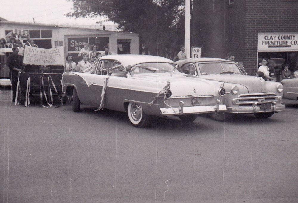
Cars parked in the Hayesville Town Square circa 1956.
Clay County is situated in the far western part of North Carolina on the border between North Carolina and Georgia. The county seat is Hayesville, NC, a small town that currently has a population of about 400 people, while the county currently has a population of around 11,000. According to the U.S. Census Bureau, the population of Hayesville was 35 people in 1870 and the population of Clay County was 2,461.
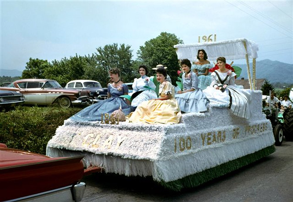
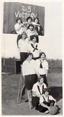
A group of young women in Victorian garb sitting on a float in the Hayesville Centennial Parade.
The photos span the years 1862-1975. A large portion of the images focus on Hayesville, NC, the county seat. The rest of the pictures focus primarily on the surrounding rural area of the county. The subjects of the photos include shop interiors, school groups, the Dam Construction at Lake Chatuge in 1941-1942, historic county documents, the Hayesville town square, the Hayesville Centennial celebration in 1961 and related events, the Tennessee & North Carolina Railroad Depot in Hayesville, and rural life in the county.
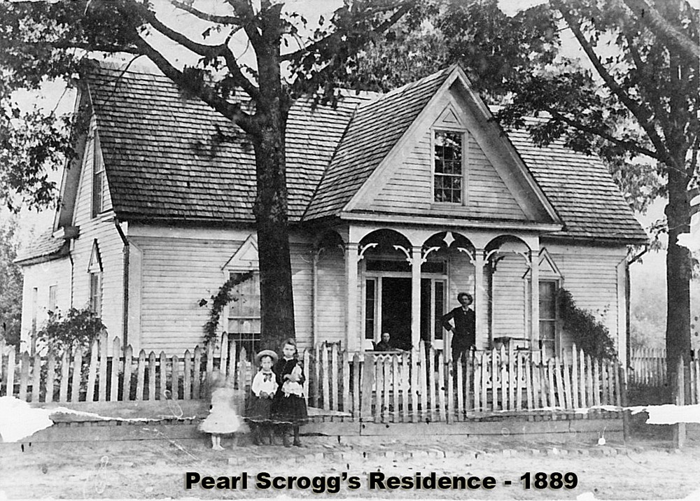
Family standing in front of Pearl Scrogg’s residence in 1889.
For more information on the Clay County Historical and Arts Council, please visit their website.
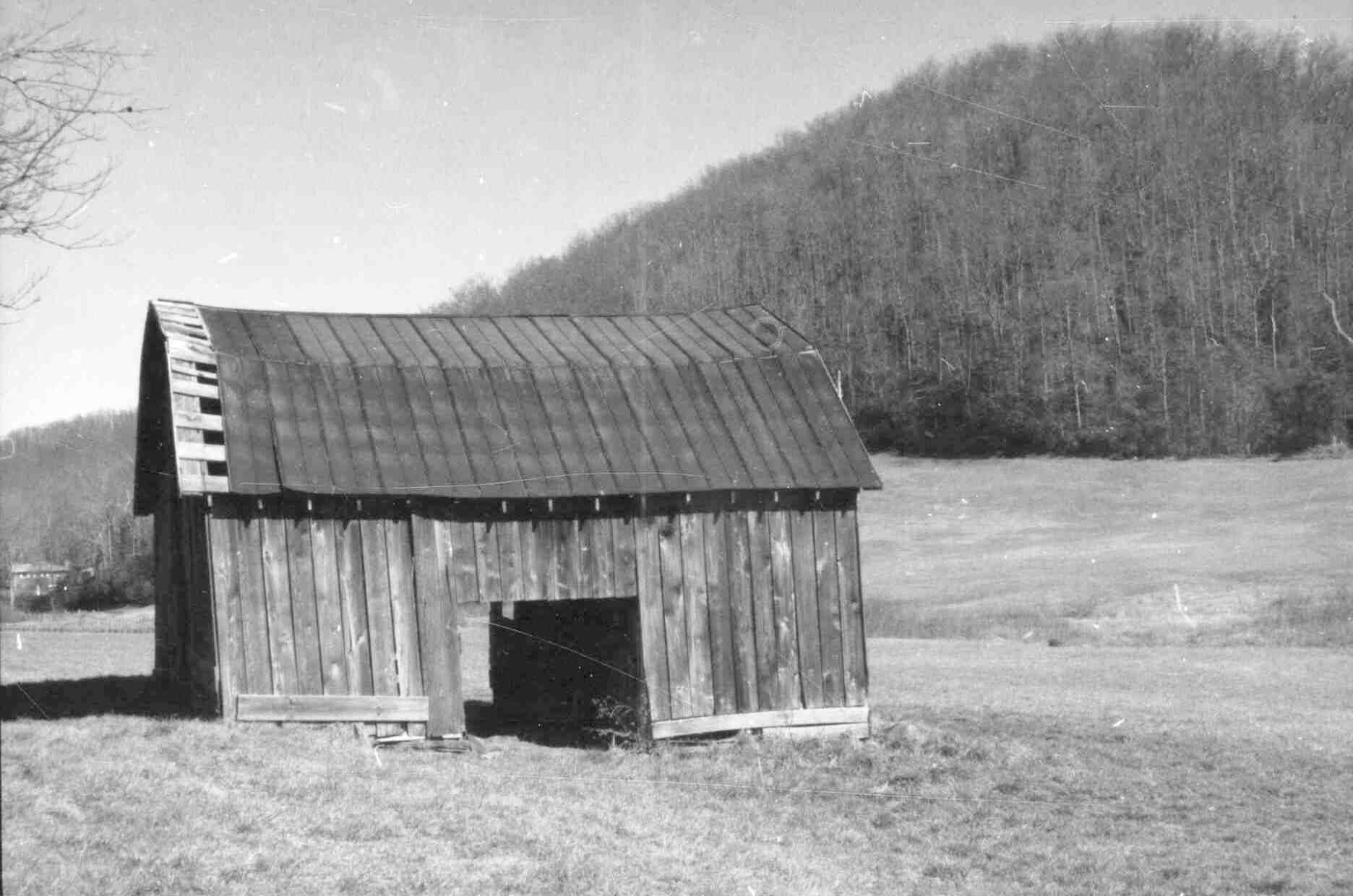
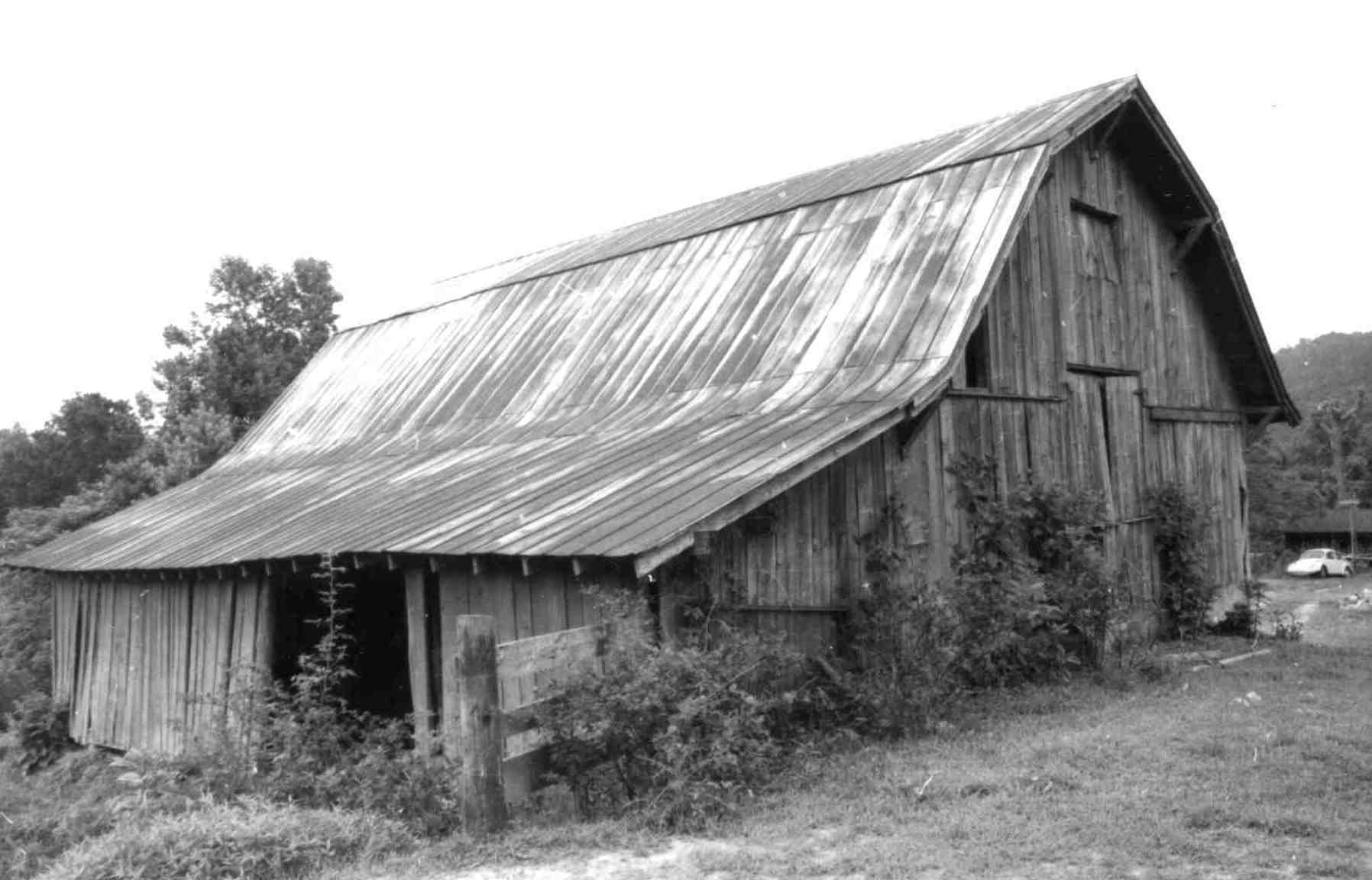
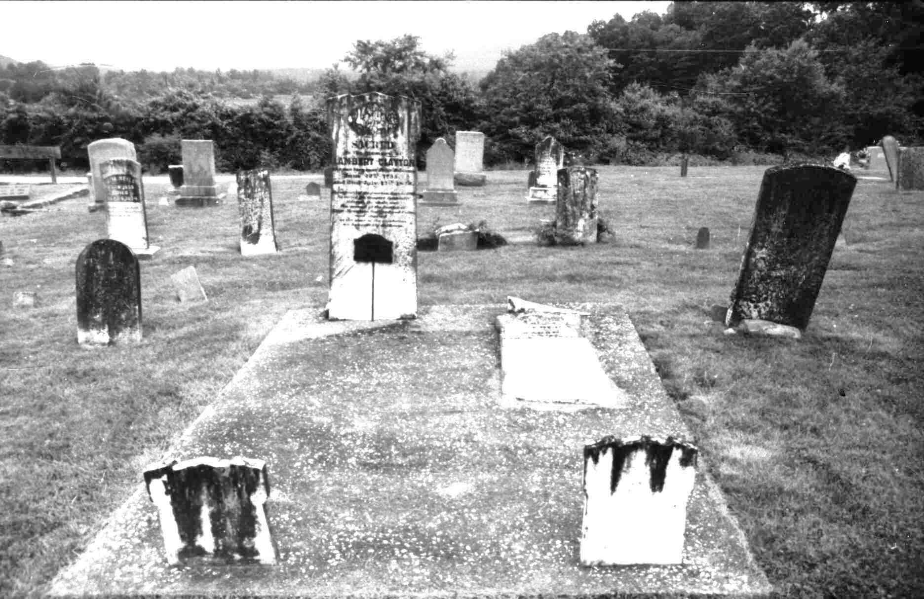
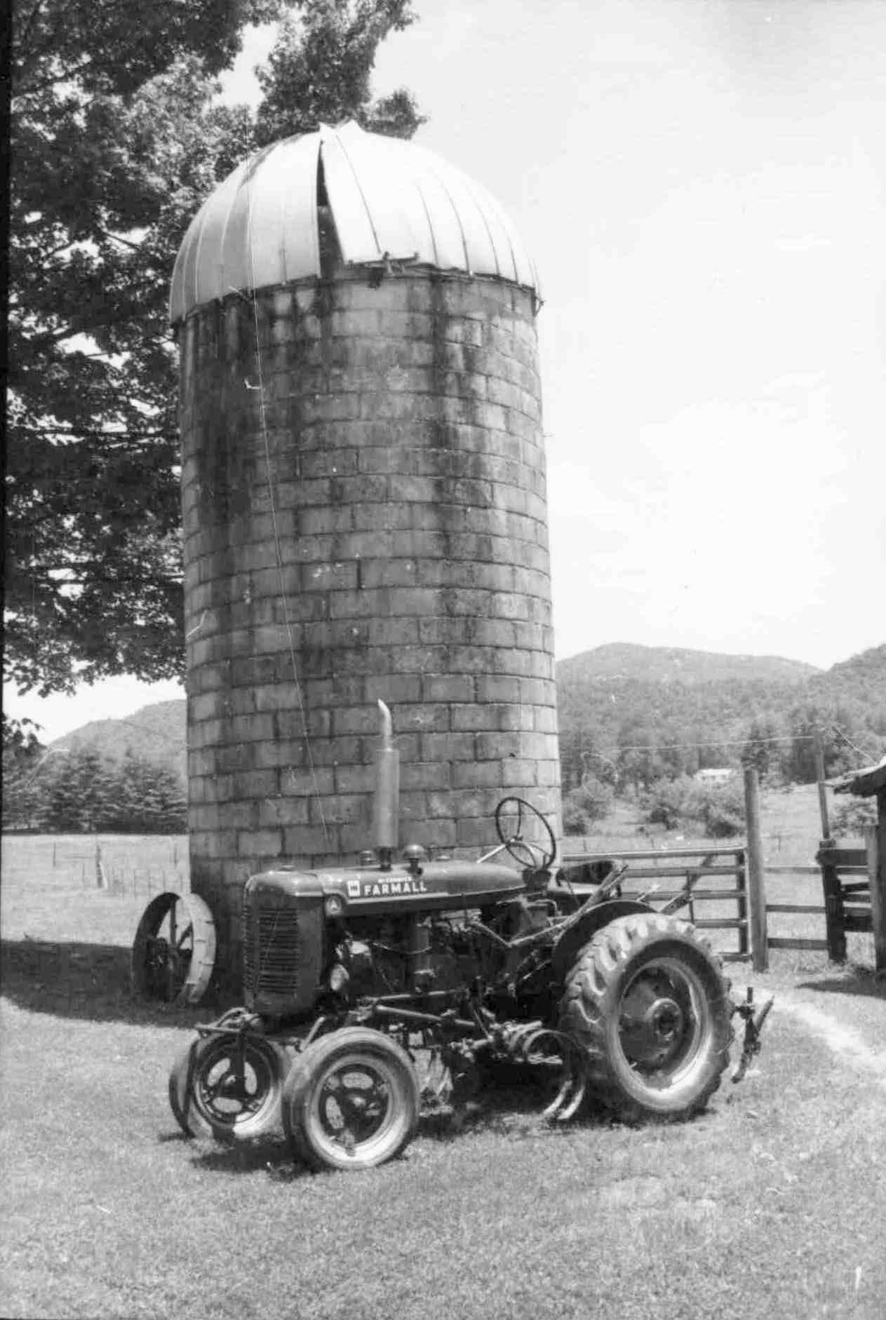
The exhibit, Transylvania: The Architectural History of a Mountain County, features nearly 1,500 images taken during an architectural survey done of the county in the early 1990s. Architectural surveys are inventories of built, intact structures in a given area. These images document structures and communities in Brevard, Rosman, Lake Toxaway, Cedar Mountain, Pisgah Forest, and other areas. The County was founded in 1861 as an agricultural community, which is evident through the survey. Hundreds of images depict homes, barns, spring houses, smokehouses, chicken houses, silos, and many other structures that reflect the activities and roots of the rural community.
In addition to farms, the survey also documents churches, cemeteries, local businesses, and schools, some of which have since been demolished. These resources include corresponding data that describe locations, family names, and historical information that could serve as excellent resources for genealogists or researchers.
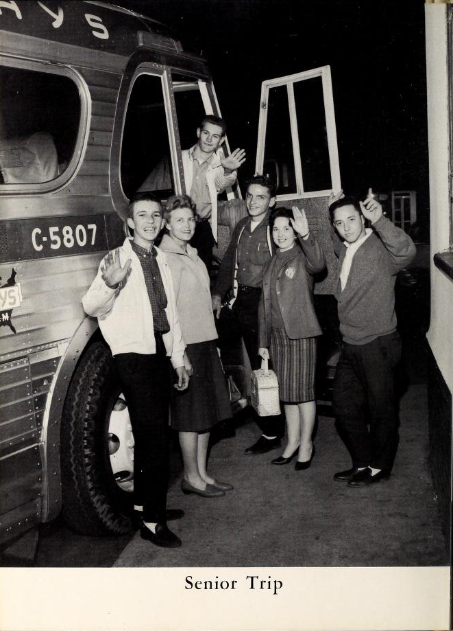
Senior Trip, from Glendale High School’s 1962 The Glen-Cedo Yearbook.
The Johnston County Heritage Center has shared more yearbooks from the 1950s and 1960s through DigitalNC. The schools represented in this latest batch are:
Cleveland High School (Clayton, NC) 1960 [View all]
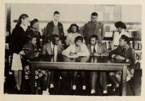
Students at Richard B. Harrison High School on their way to class in 1966.
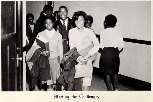
Thanks to our new partner, the Johnston County Heritage Center, 146 Johnston County yearbooks from 16 different high schools are now on DigitalNC. Many of the high schools were closed when Johnston County consolidated and integrated the school system in the 1960s, including three African American schools.
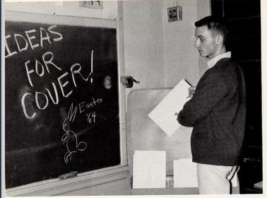
Planning the cover of Smithfield High School’s newspaper, 1964
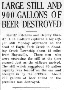
The hero of these beer busts tends to be Sherriff Kitchens, a figure as mysterious in these papers as he is dedicated to dry laws. Kitchens once went as far as the Georgia state line to track down illegal stills. All together, Kitchens and his deputies disposed of thousands of gallons of illegal alcohol and were celebrated often in the paper for it.
In the United States, copyright expires for some types of published materials a certain time period after their publication. In 2022, many materials published in the U. S. before 1927 are now out of copyright. Each year that boundary year moves forward by 1; in 2023 the boundary will be “published before 1928.” This is one of the reasons many sites like ours share a lot more materials published before that moving target. In addition, we have a workflow where certain types of publications from 1927-1963 undergo copyright review where we determine if they are likely to be out of copyright and low risk to publish online.
Because of the forward movement of the copyright boundary year and some other reasons related to fair use, we’ve been able to add the newspapers listed below to DigitalNC. These titles were also selected to help bolster representation of certain geographic areas on our site. In content, these issues feature many highlights, including descriptions of prohibition-era beer busts in Hayesville and a comical column of national news from Maxton.
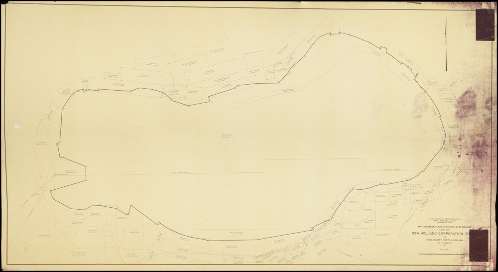
While we are no strangers to digitizing large objects here at DigitalNC, our newest partner, the Hyde County Historical and Genealogical Society, gave us quite the scanning challenge with their 1934 Mattamuskeet Lake Migratory Bird Refuge Grant Map! Measuring in at 6ft 4in by 3ft 9in, the map was over a foot longer than our largest scanning table. Since it was impossible for us to scan the whole map in one shot, we had to utilize our Phase One camera and its removable table top to scan the map in parts using a horizontal scrolling type technique.
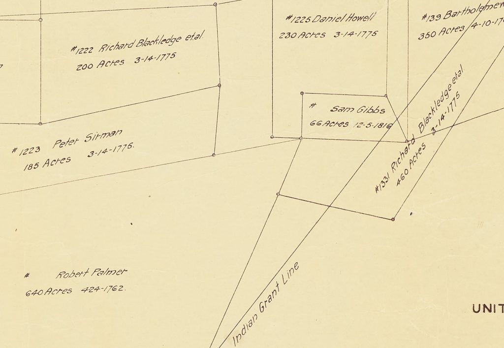
A portion of the map was set up on the table top with small weights carefully applied to hold the map in place and edges down while library carts and people supported the parts of the map off the table. Once a portion was scanned, the weights would be removed, the map shifted for the next portion (with overlap), and weights reapplied. This process was repeated over 30 times. Afterwards, the scanned images were pieced together to create an impressive full digital image of the map which shows the boundary of the lake and parcels of land along with individual parcel owner names, dates the land was acquired, and parcel acreage. A more detailed version of the map can be viewed here on DigitalNC.
Lake Mattamuskeet is recognized as North Carolina’s largest natural freshwater lake—stretching 18 miles long, seven miles wide, and averaging only two to three feet deep. While the lake may be shallow, its history is certainly not. The following paragraphs provide some information about the lake’s ancient and more recent past, but detailing its full history is beyond the scope of this blog post. If you are interested in learning more, please visit the resources that are linked at the end of this post.
At least 800 years before England’s 1584 expedition arrived at Roanoke Island, the coastal region of the state was occupied by several small Native American tribes, including the Algonquian-speaking Machapunga (also known as the Mattamuskeet or Marimiskeet American Indians). The Machapunga were a small tribe of the Algonquin language living in the Pungo River area who migrated south from the Algonquin peoples of the Powhatan Confederacy.
At that time, the Mattamuskeet were known as skillful watermen who made their boats and nets of size interlocks for herring, drum, shad, netting needles, and floats. In addition to their work on the water, they hunted; trapped; gathered berries, nuts, and fruit; and farmed. They grew plants such as corn, beans, pumpkins, goosefoot, sunflowers, knotweed, and squash. The women of the Machapunga are specifically noted as being fierce warriors. Today, the genealogical descendants from the original historic Mattamuskeet Indians of Hyde County, along with the original historic Roanoke-Hatteras (Croatan) Indians of Dare County comprise the Alogonquian Indians of North Carolina.
In 1934, the Mattamuskeet Lake Migratory Bird Refuge Grant Map was created—showing parcel boundaries along with providing the name of the parcel’s owner, the acreage, and the date it was acquired. Some names present on the map, such as Collins, Barber, Chance, Clayton, and Bryant, can trace their American Indian heritage back to the Mattamuskeet. The same year the map was published, the lake was acquired by the United States Government and the Mattamuskeet National Wildlife Refuge was established. This was likely a result of Roosevelt’s New Deal policies that helped provide jobs and relief to citizens during the Great Depression. Today, the Mattamuskeet National Wildlife Refuge (which includes the lake and surrounding area) remains federally protected and supports “large numbers of wintering waterfowl, as well as a variety of breeding songbirds, mammals such as black bear and bobcat, and other wildlife.”
To learn more about the Hyde County Historical and Genealogical Society, please visit their website linked here.
To view more maps of North Carolina on DigitalNC, click the following link.
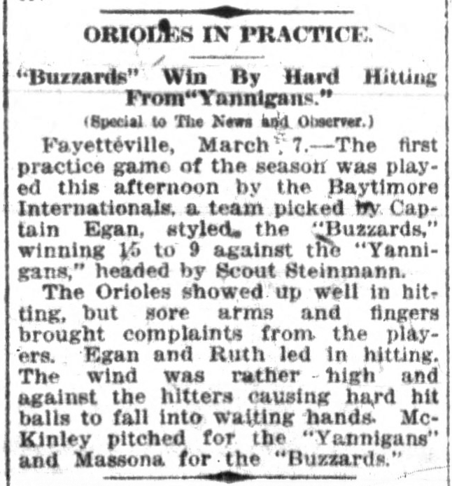
In the March 8th, 1914 issue of The News and Observers we have an article detailing a practice game played by the Baltimore Orioles while in Fayetteville. This happens to be the game where a 19 year old George Herman “Babe” Ruth hit his first home run as a professional baseball player. Ruth was also given his iconic nickname “Babe” while in Fayetteville on this trip.
The News and Observer, March 8th, 1914
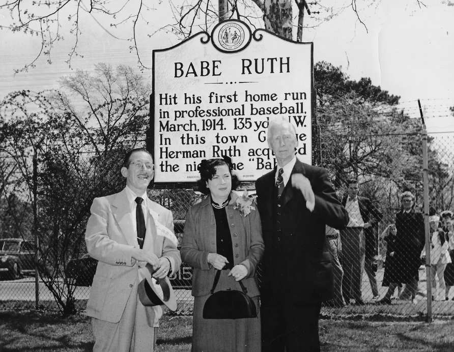
Image via The Fayetteville Observer
Over the next year, we’ll be adding millions of newspaper images to DigitalNC. These images were originally digitized a number of years ago in a partnership with Newspapers.com. That project focused on scanning microfilmed papers published before 1923 held by the North Carolina Collection in Wilson Special Collections Library. While you can currently search all of those pre-1923 issues on Newspapers.com, over the next year we will also make them available in our newspaper database as well. This will allow you to search that content alongside the 2 million pages already on our site – all completely open access and free to use.
If you want to see all of the newspapers we have available on DigitalNC, you can find them here. Thanks to UNC-Chapel Hill Libraries for permission to and support for adding all of this content as well as the content to come. We also thank the North Caroliniana Society for providing funding to support staff working on this project.
There are lots of things you can learn in higher ed—and based on our latest batch of materials from Montgomery Community College, MCC is a great place to explore some of those niche interests. In this latest batch of materials, we’ve got scrapbooks from 1968-1983 and catalogs and student handbooks from 1967-2020. These materials document some of the ways that Montgomery students have been able to explore their passions and find success in surprising areas.
From the 1989-1990 scrapbook
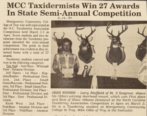
One interesting article from the 1989-1990 scrapbook tells of seven MCC students and two instructors who competed in a taxidermy competition in Apex, N.C.
“The pride in their achievement was evident as they returned home with a total of 27 awards,” the article says.
Much of the team’s success should probably be credited to instructor Mike Gillis, who received the highest state award as well as several category awards in the professional division that year.
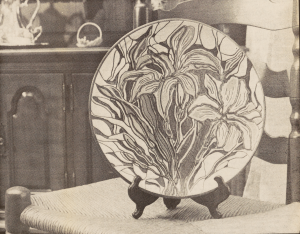
A plate from the collection of pottery instructor Mike Ferree
Another art form that Montgomery CC students excelled in was ceramics. In this article from the 1989-1990 scrapbook, pottery instructor Mike Ferree describes the way that Seagrove (in neighboring Randolph County) has become known for its ceramic arts.
“Pottery started in Moore and Montgomery counties because of the good clay,” he explained.
In the Spring 2020 catalog (one of the most recent available), the pottery program is going strong; students can choose from studio pottery, beginner handbuilding, beginner wheel throwing, beginner Raku, glass and salt pottery, and beginner pottery design.
This blog is maintained by the staff of the North Carolina Digital Heritage Center and features the latest news and highlights from the collections at DigitalNC, an online library of primary sources from organizations across North Carolina.

![Map title and associated information. United States Department of Agriculture Bureau of Biologial Survey. Jay. N. Darling. Chief.
Mattamuskeet Lake Migratory Bird Refuge Grant Map.
New Holland Corporation Tr[?].
(3)
Hyde County. North Carolina.
R.C.F. Surveyor.
1934.
Scale 1:15,840
[Bar for scale]](https://www.digitalnc.org/wp-content/uploads/2023/11/default-1-1-1024x623.jpg)