Viewing entries tagged "maps"

New on DigitalNC, Documents and Maps from partner the History Committee of the Town of Pine Knoll Shores!

Thanks to our partner the History Committee of Pine Knoll Shores, materials related to the development of Pine Knoll shores are now on DigitalNC.  This batch includes a booklet on the history of Pine Knoll Shores, correspondence relating to development in the town, and lots of maps of the town and the developments in it, including the golf course.  The materials span a 50 year period, covering 1955 to 2007.  


booklet

The Story of Pine Knoll Shores.

map

Pine Knoll Shores Golf Course.

Click here to explore this Pine Knoll Shores collection, you can also visit their partner page here and their website by clicking here.


Durham County Aerial Photographs from 1980 and a 1951 Zoning Map Recently Added to DigitalNC

Comparison of part of I-85 from 1980 and 2019

Thanks to the Durham County Library, DigitalNC now hosts several aerial photographs and maps of the county from the second half of the twentieth century. Among the 1980 aerial photographs is a 1951 zoning map, which focuses mainly on the borders of the county and shows all major roads, bodies of water, and railroads. Landmark Engineering Company from Cary, NC, took the aerial photographs on March 13, 1980. They document the landscape of much of Durham County, though some are annotated to include street names.

Each photograph is identified by a four digit number followed by a two digit number in the bottom right-hand corner of the page. This index shows all four digit zones and how they split into four sections with two digits each. Use landmarks such as roads to identify the location of the photograph or map, then these locations can be matched to current landmarks on Google Maps or a similar tool. The hand drawn sketch (left) shows which segment of the county each grouping of photographs documents.

  1. Northwestern Durham County
  2. Northern Durham County
  3. Northeastern Durham County
  4. Northeastern Durham County
  5. Northwestern Durham County
  6. Northern Durham County
  7. Northeastern Durham County
  8. Eastern Durham County
  9. Eastern Durham County
  10. Southeastern Durham County

To view all maps and photographs in this batch, click here. To learn more about the Durham County Library, visit their contributor page here or their website here.


Dozens of Maps, Booklets, Brochures and Scrapbooks from High Point Now Available on DigitalNC

An aerial shot of the city of High Point circa 1955.

40 new maps, booklets, and brochures from High Point, North Carolina have been digitized and added to DigitalNC, courtesy of our partners, the High Point Museum and the Heritage Research Center at High Point Public Library. These materials range from the 1930s all the way to 2018, really illustrating all the different ways that the city changed throughout the 20th century.

There is a huge variety of materials in this batch. The scrapbooks contained in this collection date from 1931 to 1944 and focus on municipal issues in High Point and the Piedmont Triad. Over a dozen booklets and programs are also included that are from the Community Leadership Development Program of the High Point Chamber of Commerce. These booklets memorialize the programs designed to inform community members about local issues and businesses, encourage productive discussion and develop future local leadership.

The 1992 class of Challenge: High Point attending a meeting at WGH Piedmont.

A number of other booklets are included as well. Many of them contain statistics about High Point at that date, including its tax rates, municipal features, population sizes, what industries are there, per capita incomes, and more. Many also contain photos of local institutions and colleges, as well as larger maps of High Point. Finally, this collection also contains several maps by themselves, including one map of High Point that highlights city limits, and others that highlight High Point as it is in 2013 and 2018.

To see more from the High Point Museum, take a look at their partner page, or visit their website. To learn more from the Heritage Research Center at High Point Public Library, please check out their partner page, or take a look at their website.


Dozens of New Maps from Western Carolina University Show Off the WCU Campus, the Blue Ridge Parkway, and More

Over 50 new maps and blueprints have been digitized and added to DigitalNC, courtesy of our partner, Western Carolina University. Stretching from 1927 to 1988, these maps detail the Blue Ridge Parkway, the Great Smoky Mountains, Jackson County, the Appalachian National Scenic Trail, and more.

A section of the master plan to WCU, dated April 1978. E.J. Whitmire Stadium is in the top right.

There is a huge amount of variety in the maps in this batch. One map from 1930 includes planting and sectional plans for the Rock Garden Memorial at Western Carolina University. Other maps, such as the Cullowhee Quadrangle Map, were commissioned by the Tennessee Valley Authority to map entire towns like Cullowhee, Sylva, and Dillsboro and mountain ranges. Several maps were double-sided, and included local information or scenic photographs of interest on the reverse side.

This batch also introduces orthophotos to DigitalNC, the first of their kind on our website. Aerial photographs that have been scale-corrected for use in geographic information systems (GIS), these orthophotos show us how Jackson County looked from above in the 1980s. As you can see, the 1980 orthophoto featured below corresponds to how WCU was plotted out in the master plan above.

The equivalent orthophoto of the above master plan showing WCU, dated April 1980. E.J. Whitmire Stadium is in the top right.

The majority of the maps from this collection detail the Blue Ridge Parkway throughout western North Carolina and Virginia, drawn by the Department of the Interior National Park Service between 1942 and 1967. We also have the privilege to include eight segmented maps of the Appalachian National Scenic Trail from the 1980s.

All of these maps and additions represent an important addition to our collection of knowledge about the Appalachians. To see more materials from Western Carolina University, visit their contributor page or visit their website.


New Blueprints, Maps, and Artifacts from the Chapel Hill Historical Society Tell the Story of Chapel Hill

Almost a hundred new maps and blueprints have been digitized and added to DigitalNC, courtesy of our partner, the Chapel Hill Historical Society. Dated from 1875 to June 2007, these maps illustrate how much the city of Chapel Hill and Orange County has changed in the last century and a half.

A map of how Chapel Hill would have appeared in 1818. Franklin St and Columbia St are featured.

This new batch contains many different types of maps and blueprints, including maps of Chapel Hill neighborhoods, site plans for individual properties, blueprints of the Chapel Hill Public Library and its additions, maps of the city’s outer limits, and township tax maps.

A color-coded map of the Glen Lennox properties circa 2008

Beyond recent maps of Chapel Hill, this batch also includes several other interesting items. One map sketches Orange County, as well as the neighboring counties that ceded land between the years of 1752 and 1849. Another sketches the state of North Carolina as it appeared in 1753, when Anson and Rowan Counties stretched to the west. Another map, from 1976, sketched Chapel Hill as it would have appeared in 1818.

Other items in the collection tell their own Chapel Hill stories. In 1925, R.L. Strowd, a local landowner, sold a number of lots throughout Orange County, and those deeds of land sales are also included in this collection. Another record of land sale is included, when Samuel Morgan sold land to Jesse Hargraves in 1845 for the cost of $4,300. This batch of items also includes a book that contains detailed maps of the Chapel Hill and Carrboro area from the 1960s through the 1980s, as well as an informational pamphlet from 1953 advertising the Lake Forest neighborhood of Chapel Hill.

By adding yet more maps, blueprints and artifacts to our collection, we can learn and understand more about the city that DigitalNC calls home. To see more materials from the Chapel Hill Historical Society, visit their contributor page or check out their website.


Maps, Sketches, and Blueprints on DigitalNC from our new partner Wrightsville Beach Museum of History

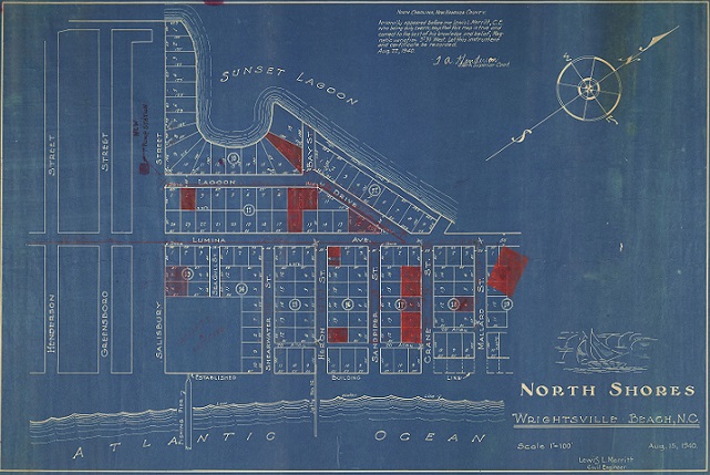
A blueprint of the North Shore of Wrightsville Beach, with buildings, pipes, and pump stations marked in red.

Over four dozen historical maps, blueprints, and more have been digitized and added to DigitalNC, courtesy of our new partner, the Wrightsville Beach Museum of History. These maps, some dating back to as early as 1923, cover many different parts of the Wilmington and Wrightsville Beach areas and really illustrate to us how wide and varied the geography of New Hanover County really is.

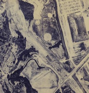
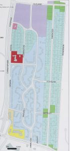
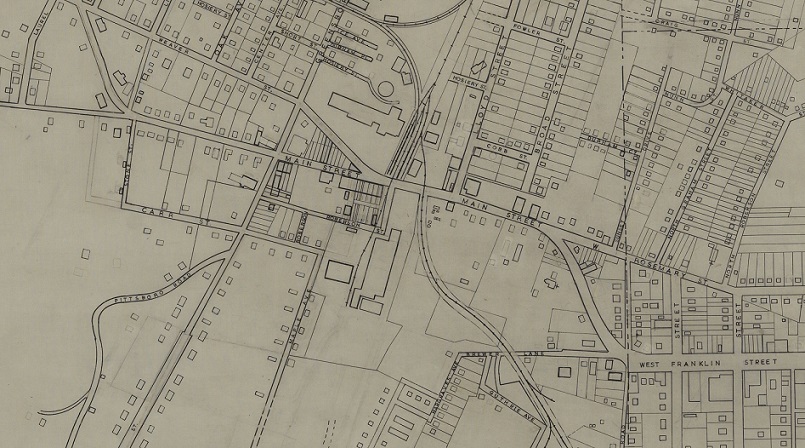
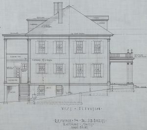
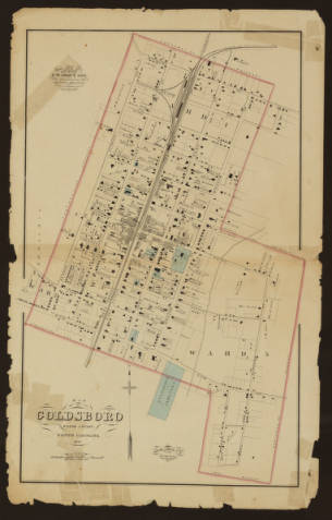
Many of the blueprints detail buildings around Wrightsville Beach, while others show plots of land and city streets. Several of the maps are designed to show specific buildings and building sites, such as the former Babies Hospital at Mott’s Creek in Wilmington. Others are geological cross sections, showing tide lines, jetty locations, and inlets along the coast. These are invaluable blueprints for tracking the coastline, as well as illustrating how the beaches and the towns around them have changed over time.

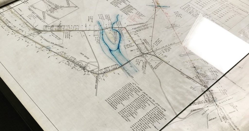
A photo taken during the mid-scanning process of one of the larger, composited maps of Wrightsville Beach

Many of these maps are massive, with some stretching to nearly 6 feet in length. A few of the aerial shots of Wrightsville Beach were even longer, requiring a small team to handle the map just to make sure it could be documented. As a result, it was a slow process for us to roll out these maps and blueprints, scan them using our overhead camera, composite them into complete shots, and prepare them for production. We have posted an instructional video on our Flickr page to show and explain how we scanned them. Many of them, including the aerial view of Wrightsville Beach, took 3 and sometimes 4 individual shots to stitch together, resulting in images that were sometimes over 8000 pixels high and over 10000 pixels wide.

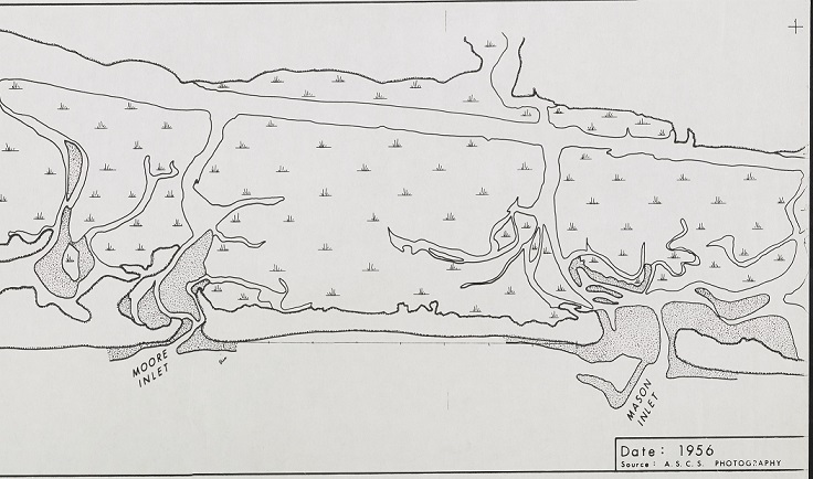
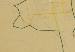
A portion of a 1956 map from the A.S.C.S. showing Moore Inlet and Mason Inlet.

These maps were in excellent condition, and we are honored in being able to digitize them and host them for everyone to see. To learn more about the Wrightsville Beach Museum of History, please visit their contributor page or their website.


Maps, Sketches, and Blueprints from Chapel Hill Historical Society Now Online at DigitalNC

A portion of one map of Carrboro and Chapel Hill – showing Franklin St, Main St, and Greensboro St.

Nearly three dozen maps and blueprints have been digitized and added to DigitalNC, courtesy of our partner, the Chapel Hill Historical Society. Dating from 1929 to 1963, these maps really illustrate how much the city of Chapel Hill has changed in the last century.

Blueprint of the west side of Dr. J.B. Bullitt’s house in Chapel Hill.

This new batch contains many different types of maps and blueprints, including cross sections of the Chapel Hill Municipal Building, a survey of East Rosemary Street, cross sections of local doctor J.B. Bullitt’s home, and Planning Board maps of the Chapel Hill and Carrboro region. Also included are maps for proposed developments of segregated cemeteries, which would have been established next to NC state highway 54. These maps are fascinating to see and compare to what we know of the area today, and to see how much has changed since these maps were created.

These maps are very large, with some stretching out to be over 6 feet in length! While most could be scanned with our overhead PhaseOne camera (our process is documented on video here), several were so large that they had to be framed in a vacuum-sealed rotating container so that they can be preserved in the highest quality. Some of these largest ones took two different shots to compose together, resulting in images that were 7000 pixels tall by 11000 pixels wide. That’s far larger than anything even the most high-tech cell phone cameras can shoot.

One of the maps being scanned inside a vacuum-sealed container for maximum quality

Having these maps and blueprints in our collection is very important, as it helps us understand the changes to the city which DigitalNC calls home. To see more from the Chapel Hill Historical Society, visit their partner page, or take a look at their website.


A Visit from Wayne County Public Library

A few weeks ago, our partner Wayne County Public Library brought three over-sized materials for us to scan here at the NCDHC while they waited.  The items were a beautiful map of Goldsboro from 1881, and two posters related the building campaign for a memorial building in honor of those from Wayne County who died in World War I.  

1881 map of Goldsboro, NC

While we scanned these items, folks from UNC Communications stopped by to see us in action.  You can see the footage they shot of our scanning processes here.

Learn more about our partner Wayne County Public Library on their partner page, or on the Wayne County Public Library website.


Maps and scrapbooks from High Point institutions now online

Five new scrapbooks from High Point have been digitized and are now available at DigitalNC, courtesy of our partner, the Heritage Research Center at High Point Public Library. These scrapbooks date from December 1962 to October 1965. They join previously digitized collections, dating back to 1952.

A scrapbook page from April 1964 with articles on urban renewal in High Point and a proposal for a shopping complex on N. Main St.

These scrapbooks contain newspaper clippings from the High Point Enterprise and Greensboro Daily News, arranged in chronological order. In many cases, articles were pasted and taped into the scrapbooks overlapping each other, so digitizing required taking multiple images of each page. Many of the newspaper clippings relate to local events in High Point and Greensboro, including political events and local races, decisions about local laws and town planning. Every so often, national events are also included, like the Beatles’ tour of the United States in 1964.

To view the individual scrapbooks, visit the links below:

A 1964 map of High Point and the surrounding area.

From the High Point Museum we have added ten new maps and atlases of High Point from the 1950s to the mid-1970s. The maps show roads, schools, municipal buildings, schools and local businesses in the High Point area and surrounding suburbs. Occasionally there are larger maps with information about Greensboro or Winston-Salem. Many of the maps also include facts about High Point, like the population, number of churches, list of media outlets, and photos of local businesses being highlighted.

To see more materials and learn more about the Heritage Research Center at High Point Public Library visit their partner page or take a look at their website.  Visit the High Point Museum’s website or High Point’s partner page to learn more about them.


Set of Maps from Johnson C. Smith University Show McCrorey Heights Neighborhood in Charlotte

The heading of a 1949 property map of McCrorey Heights

A set of maps contributed by our partner, Johnson C. Smith University, show property divisions over time in the McCrorey Heights area of Charlotte, North Carolina. McCrorey Heights is a neighborhood in west Charlotte that was established by Johnson C. Smith University President H. L. McCrorey at the turn of the century. In the early 1900s, the neighborhood was a home to the city’s Black professional class and continues to be heavily associated with Johnson C. Smith University.

The six maps show the area from 1912-1949, and changes in the neighborhood property lines can be tracked over this time period. The 1949 maps include names of community member associated with each section of property along with other hand-written notations. These maps help tell the story of Charlotte’s history.

To see more materials from Johnson C. Smith University, take a look at their DigitalNC partner page or visit their website to learn more.


DigitalNC Blog Header Image

About

This blog is maintained by the staff of the North Carolina Digital Heritage Center and features the latest news and highlights from the collections at DigitalNC, an online library of primary sources from organizations across North Carolina.

Social Media Policy

Search the Blog

Archives

Subscribe

Email subscribers can choose to receive a daily, weekly, or monthly email digest of news and features from the blog.

Newsletter Frequency
RSS Feed