This website uses cookies and similar technologies to understand visitor experiences. By using this website, you consent to cookie usage in accordance with our Privacy Policy.
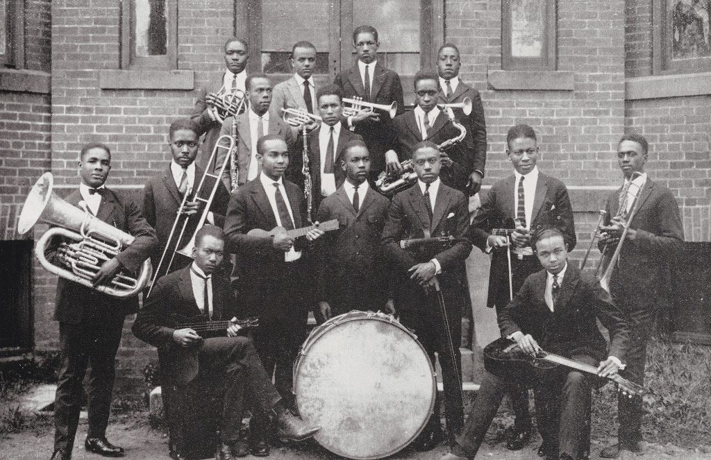
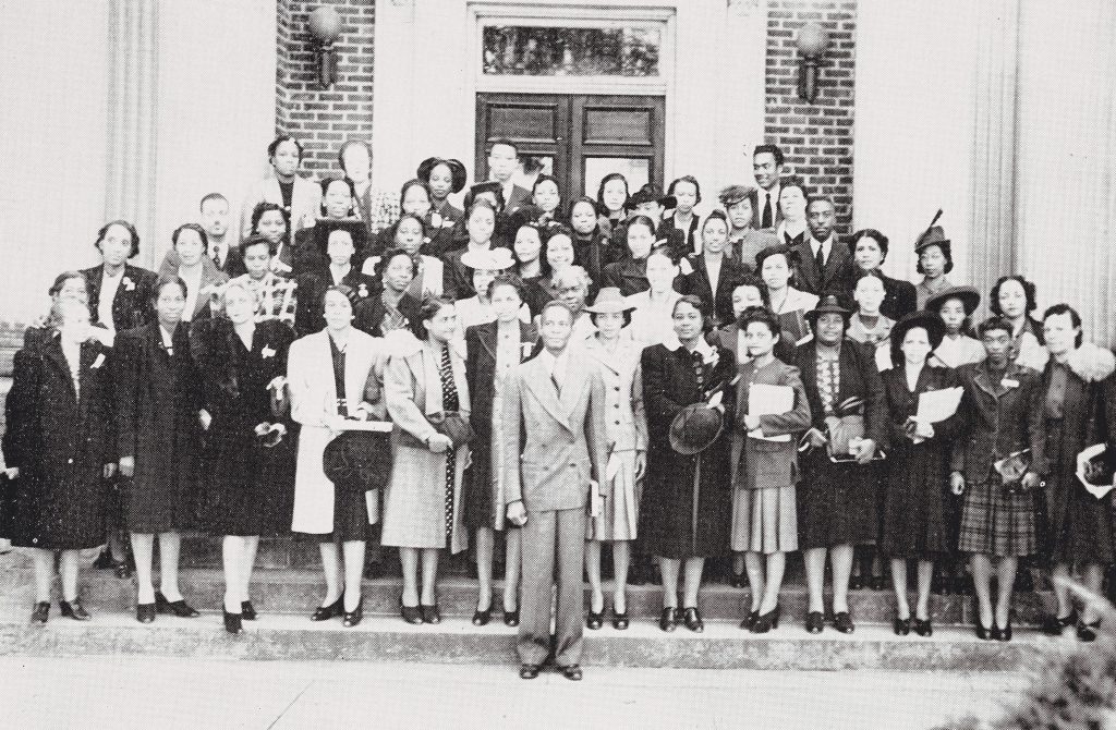
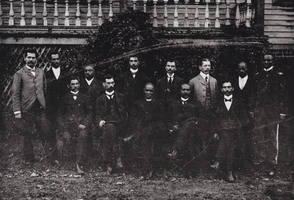
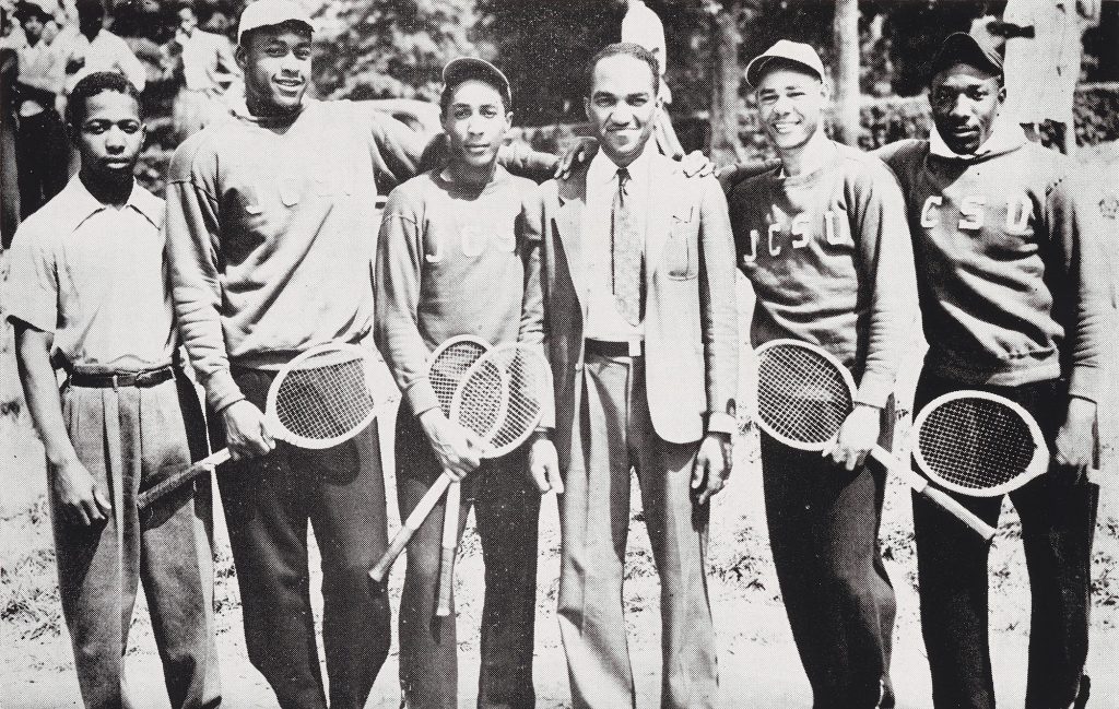
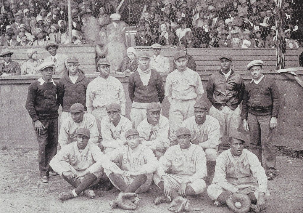
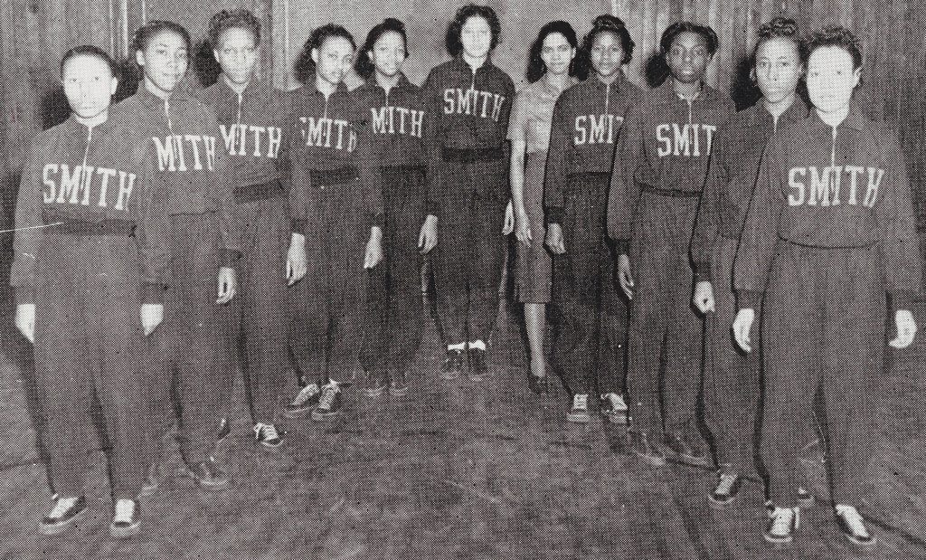
The 1942 commencement number of the Johnson C. Smith University Bulletin is important to note for its celebration of the university’s 75th year. Inside, the bulletin not only includes a copy of the commencement address, but a history of university along with some great photographs.
Looking to connect Raleigh to Wilson, the Raleigh and Pamlico Sound Railroad (later named Norfolk and Southern Railroad) investors sought to lay track through the already established Town of Wakefield, but were turned down by property owners. Instead, the investors moved the connection site 1.5 miles south of Wakefield. From this connection site, the Town of Zebulon was born, receiving its charter on February 17, 1907. In addition to the train connection site, Zebulon’s increased growth can be attributed to its status as having the best soil for growing tobacco in eastern North Carolina as well as a tobacco market which opened in 1917. Tobacco, however, was not the only crop grown in Zebulon.
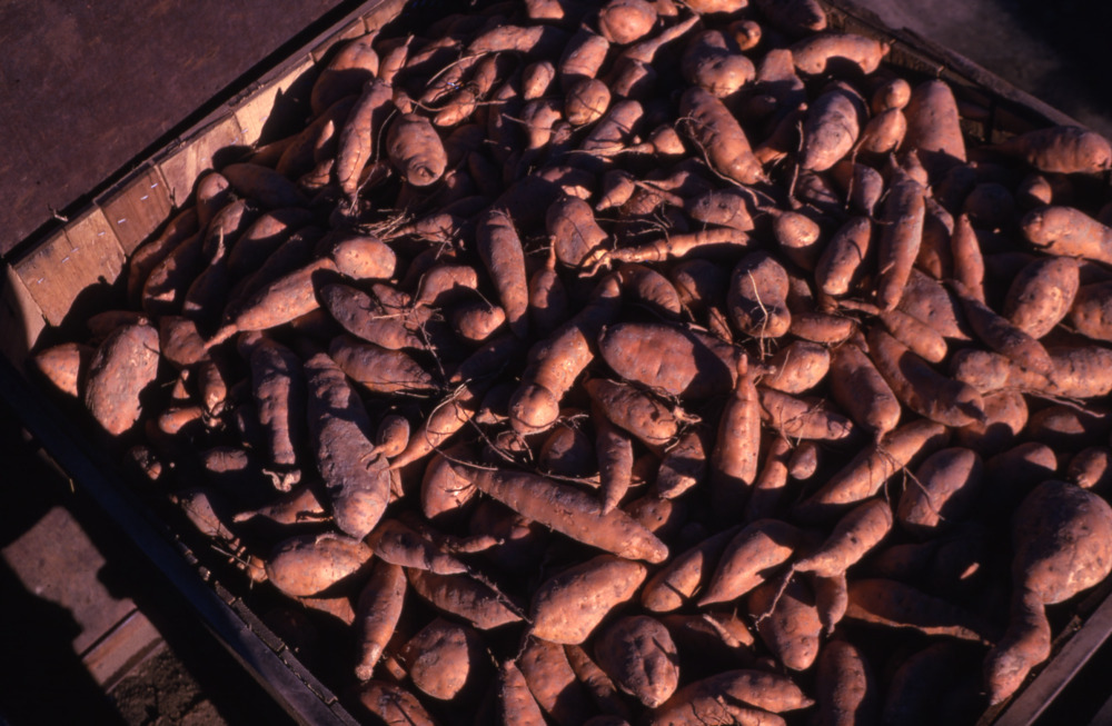
Originating in South or Central America, sweet potatoes have been grown in North Carolina since at least 1723. Linked to the decline in tobacco, North Carolina farmer began using their surplus land to grow sweet potatoes. Since then, North Carolina has risen to the largest producer of sweet potatoes in the United States. In 2021, the state produced 64% of America’s total production.
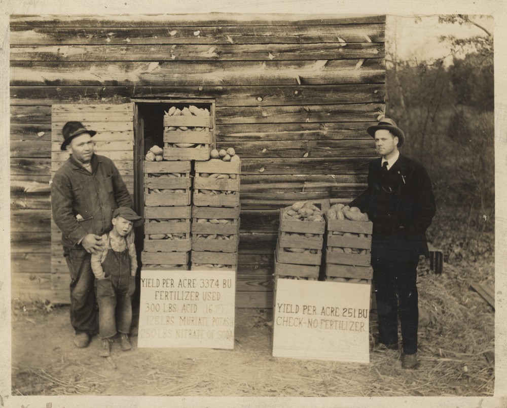
At a Zebulon Farm Bureau meeting in February 1955, Foster Finch proposed farmers grow sweet potatoes on the land that would be unused that season as a result of reduced tobacco allotments. Finch, the Wakelon Trading Corporation operator, even agreed to provide storage space for the sweet potatoes (minimum 15,000 bushels of course), along with taking responsibility for curing them. However, without a marketing outlet for the sweet potatoes at the time and lack of confidence that they would be able to produce the minimum bushels, farmers were timid to join the project.
To combat this, a marketing specialist from the North Carolina Department of Agriculture [May 13, 1955] as well as sweet potato and NC State Extension experts were brought to Zebulon to teach farmers the best growing techniques and discuss factors they should consider in producing and marketing their sweet potatoes. View our newly added issues from 1956 to 1963 of The Zebulon Record to learn more about the outcome of the sweet potato project.
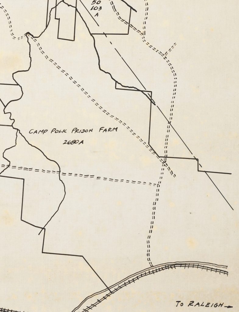
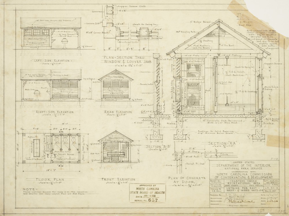
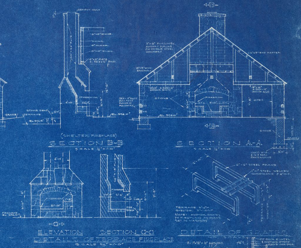
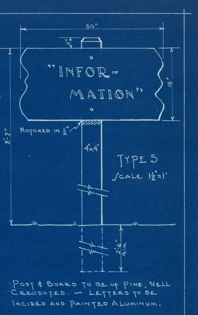
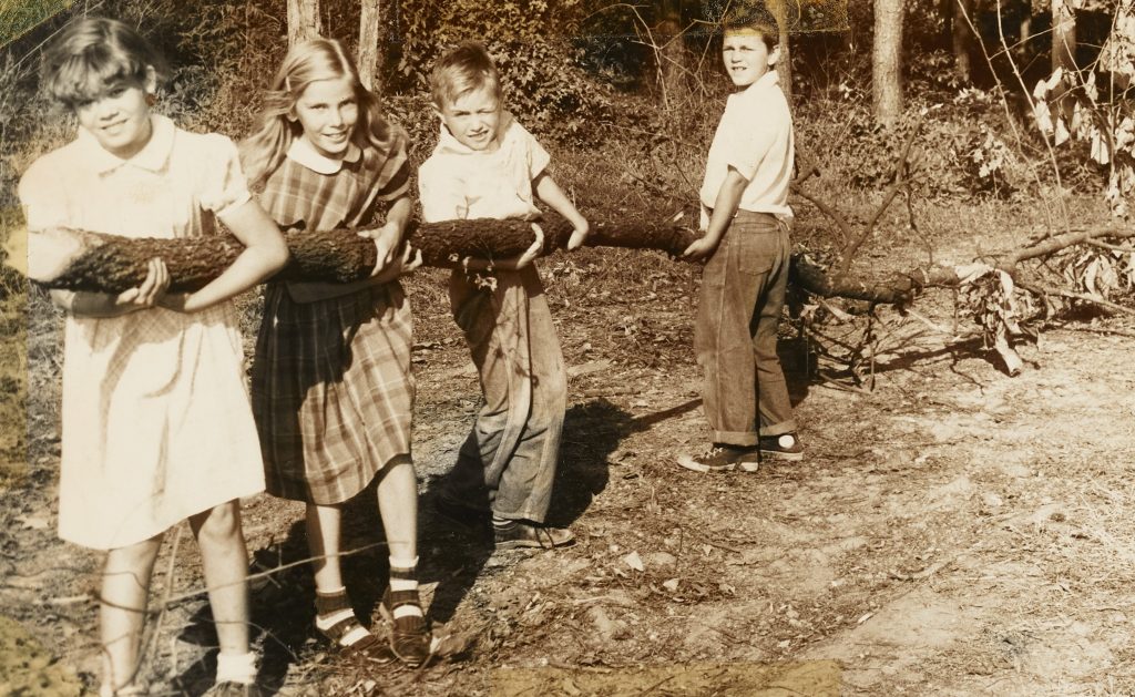
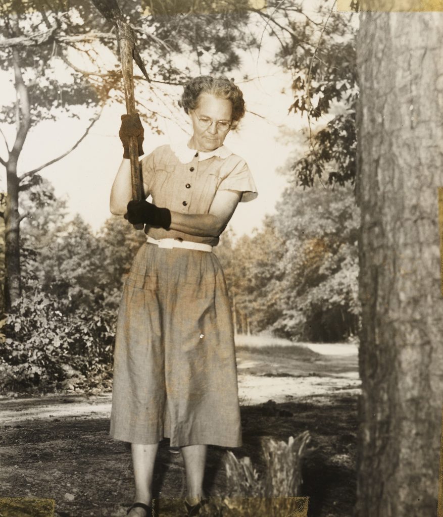
Thanks to our newest partner, William B. Umstead State Park (WBU), a batch containing over 150 new records are now available on DigitalNC. This batch holds a wealth of William B. Umstead State Park’s history featuring everything from plats, detailed construction plans of the park during the Great Depression when the Civilian Conservation Corps (CCC) was active, blueprints of a swimming pool, plans for the segregated park areas, plant information, planting schedules, and much more. One of many fascinating finds in this batch was the mention of the Camp Polk Prison Farm (also referred to as Cary Farm) on an ownership map of what would become the Crabtree Creek Recreational Area (now WBU) and the CCC era building plans.
In 1920, the Central Prison bought the former World War I tank training facility site and converted it into the Camp Polk Prison Farm. Totaling around 2,700 acres, the farm was equipped with livestock, modern farm equipment and machinery, cotton gin, dairy, saw mill, along with a modern fireproof brick and steel dormitory built using prison labor.
According to the November 1928 issue of Prison News, Camp Polk Prison Farm was set aside as a juvenile farm for white male prisoners under 21 to separate them from the older, seasoned criminals. However, not all prisoners under 21 were automatically qualified to be placed at Camp Polk farm. Mr. Pou, superintendent of the state’s prison at the time, notes only individuals who showed adaptability and “a readiness to deserve the favors tendered.” While at the farm the prisoners were required to work doing farm cropping, clearing new lands, canning, running the diary, and other tasks. Prisoners were also given the opportunity to receive instruction at night from individuals who were noted as educated and/or “capable honor grade” prisoners.
By 1927 the farm was a very profitable investment for the Central Prison. The September 1927 issue of Prison News, reported that the prison camp was “producing a great portion of its meats and food stuffs as well as supplying the Central Prison and the camps in part with fresh vegetables […]” and was “reputed to be worth by capable authorities easily over a half million dollars more than its cost to the State seven years ago, and has proved one of the best investments the State every made.”
Working collaboratively, state and federal agencies purchased 5,000 acres of land which included the Camp Polk Prison Camp under the federal Farm Resettlement Administration to develop a recreation area in 1934. The Crabtree Creek Recreational Area (now WBU) project provided jobs to individuals through the CCC and Works Progress Administration. Three years after the purchase of land, in 1937, the park opened with four camps along with day-use and picnic facilities. Plans and maps of the area and buildings during this period are present in this batch, including the latrine plans for the east, west, and middle units in Camp 2-G seen above.
In 1943, North Carolina bought the recreational area from the federal government for $1 and it was renamed to Crabtree Creek State Park. Although the park was not officially segregated up to this point, it was established that there were two separate entrance for white and Black individuals. In April 1950, however, the State of North Carolina officially segregated the park after converting 1,234 acres in the southern section into a Black park which was named Reedy Creek State Park. The white park retained the Crabtree Creek State Park name until 1955 when it was changed to William B. Umstead State Park. In the early 1960s, the parks were desegregated and eventually recombined in 1966 to form under the name William B. Umstead State Park. However, the impression of racial segregation can still be seen today with the park’s two separate entrances.
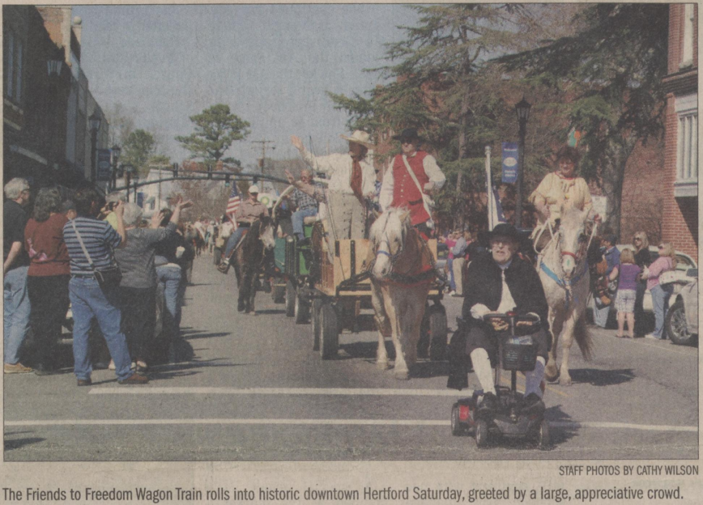
Commemorating the migration of Quakers from Perquimans County to the Northwest Territories during the late 18th and early 19th centuries, individuals donned their best Quaker costumes and hopped on their horses or into their horse-drawn buggies and wagons to participate in the Friends to Freedom Wagon Train that traveled through Perquimans County from March 17th to 20th in 2011.
The first two days of the event were set aside for riding the planned 25 mile trail. They started their journey at the Newbold-White House campsite, making stops in Beech Springs, Belvidere, Bagley Swamp, and Winfall. In Belvidere, around 400 people came out to celebrate the train with vendors, live entertainment, wagon rides, food, and promotion of the area’s historical homes and buildings.
On the last leg of the journey, the Train took the Causeway and historic S bridge to parade through Hertford before finally coming back to the Newbold-White House. The final day of the event ended with breakfast, a church service, and a driving course competition at the Newbold-White House site.
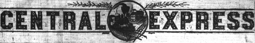
Over 1,700 issues of The Central Express and The Sanford Express are now available to view thanks to our partner Lee County Libraries and funding from the Library Services and Technology Act (LSTA). According to the Library of Congress, the paper was published under name The Central Express from ~1886 until 1891 when it was changed to The Sanford Express. This batch adds issues from a period of urbanization as well as agricultural and industrial expansion in Lee County from the late 19th to the early-to-mid 20th century.
From 1880 to 1919, Sanford saw agricultural and industrial expansion and community growth as a result of improved transportation. During this period, a large Black community began to take shape in Sanford with the establishment of business and residential district centered on Pearl Street. Individuals who did not work in the Pearl Street businesses in Sanford farmed; worked in the county’s brownstone quarries, sawmills, turpentine distilleries; or in building trades.
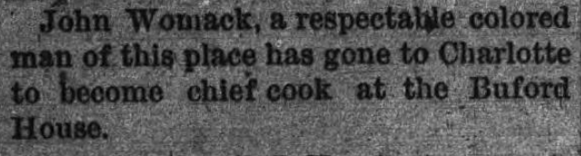
John and David Womack are specifically mentioned in the National Register of Historic Places application submitted in 1993 for the “Historic and Architectural Resources of Lee County, North Carolina, ca. 1800-1942,” as Black business operators. According to the application, the two were operators of a brickyard located near Sanford in the 1890s. Interestingly, John Womack is mentioned in the September 29, 1889 issue of The Central Express as being “a respectable colored man of this place,” that went to Charlotte to “become chief cook at the Buford House.” There appears to be no follow-up in The Sanford Express for John Womack’s return to Sanford in the 1890s to operate the brickyard.
Information about Sanford was taken from the NPS National Register of Historic Places application, seen here.
Thanks to our partner, Rowan-Cabarrus Community College, a batch of audiovisual materials are now available on DigitalNC! The materials primarily highlight the accomplishments of and programs at Rowan-Cabarrus Community College. This includes one video that features the Live Model Competition and Fall 1999 RCCC Cosmetology Long Hair Mannequin Competition. In these competitions, cosmetology students at RCCC create day and/or evening looks which are then judged and ranked. The images below show some of the amazing talent and creativity of the RCCC cosmetology students!
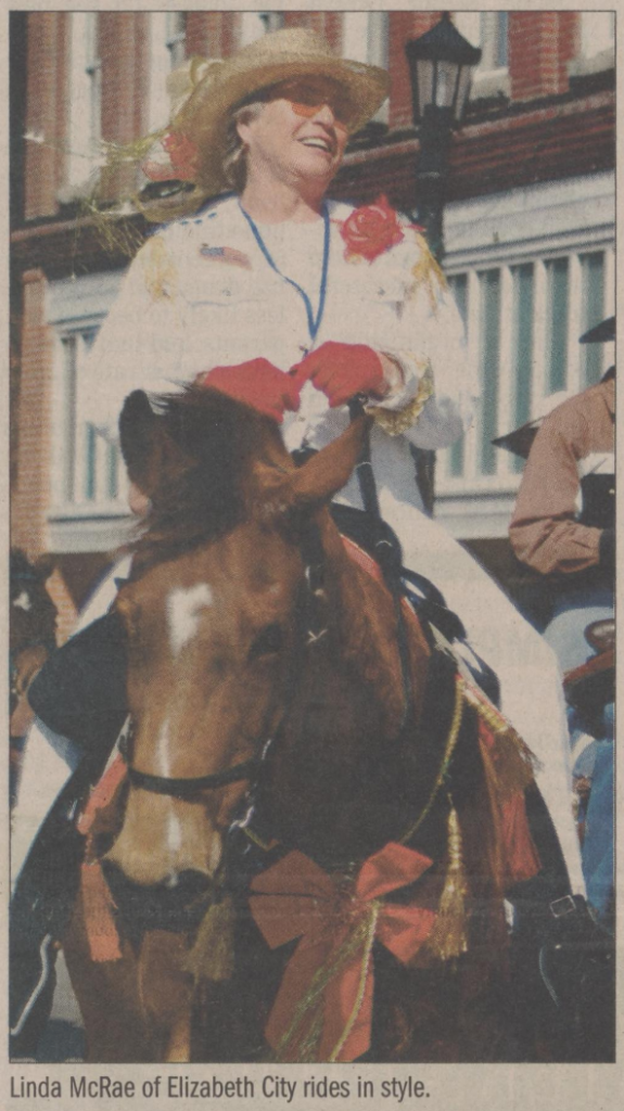
Thanks to our partner, the Museum of the Albemarle, several batches of materials are now available on DigitalNC! The first batch adds several new titles and issues of older Elizabeth City, N.C. newspapers spanning from the 1800s to 1900s.
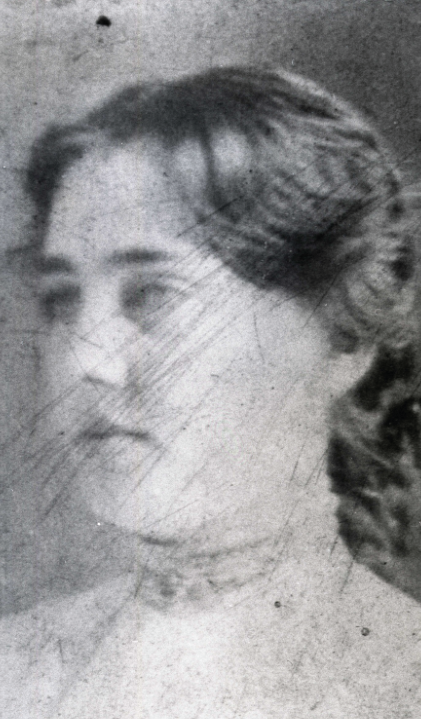
The second batch of materials contains two magazines and several newspaper clippings highlighting notable Elizabeth City news. Two of the newspaper clippings present in this batch, one from 1902 and the other 1941, directly deal with the infamous Ella Maude “Nell” Cropsey murder in Elizabeth City. The details of the case are provided below using newspaper articles from this batch along with others in our newspaper collection.
According to Ollie Cropsey, her sister Nell Cropsey and James “Jim” Wilcox met in June 1898, just two months after the family moved to Elizabeth City. In the early days, James would come over to see Nell every Sunday and eventually started to come over almost every afternoon. During their time together the two would go on walks, rides, sail, and see shows. However, in the fall of 1901 the two started getting into arguments and spats. After a period of silence and the arrival of Ollie and Nell’s cousin Carrie, the two began speaking again. The night Nell went missing from her family’s waterfront home in Elizabeth City, she was socializing with her visiting cousin Carrie, sister Ollie, LeRoy Crawford, and James Wilcox.
That evening, on November 20, 1901, around 11:10PM, Nell escorted Wilcox presumptively out of the house. About 15 minutes later, Crawford left as well. After the departure of Crawford, Ollie closed the door and windows and went to the bedroom she shared with her sister. She was surprised to find that her sister was not yet in their room, but figured she was either still talking with Wilcox outside or in the dining room and either went to sleep or stayed awake until 12:30AM depending on which newspaper issue you read. Whether she went to sleep or stayed awake, a commotion on the property had Mr. Cropsey getting his gun to defend his pigs. At that point, Ollie told her father to not shoot as James and Nell were potentially in the yard. Not finding Nell in the near vicinity, they began to search for her. Still unable to find her, the family enlisted the help of the community the following day. The search came to an end on December 27th when her body was found close to her home on the surface of the Pasquotank River. Wilcox was found guilty of second degree murder in 1902 and sentenced to 30 years.
According to the newspaper clipping from the March 13, 1941 issue of The Daily Advance, Wilcox’s father—former sheriff of Pasquotank County, Thomas Wilcox—tried several times to have him pardoned on petitions. The pardons were denied by governors two separate times supposedly as a result of Wilcox’s attitude during the search for Nell and towards the Cropsey family during the trial. In 1918, however, Wilcox was pardoned by Governor Thomas Bickett after writing the governor a “humble letter […] declaring innocence.”
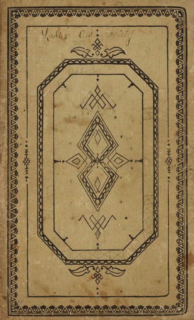
The Ladies’ Aid Society minute books are a fascinating resource for learning not only about women’s public life and women’s societies, but noted challenges in Mount Holly and how they were being addressed by a portion of the community. These minute books also feature lists of member names, attendance records, constitution and by-laws, mission statements, and handwritten documents detailing the history of the Society and its different iterations from 1896 to the 1920s.
The Ladies’ Aid Society of the Mount Holly Presbyterian Church was started on October 13, 1896 when the reverend called a meeting of the ladies of the church to organize. The Society was fairly active from 1896 to 1899 with members of the Society making bonnets, aprons, quilts; using dues to help pay for church improvements and debts; and donating to the Barium Springs Home for Children.
Around 1900, there was a period of inactivity until early January of 1906, when the ladies of the church met with the pastor to revive the Society. From 1906 to 1917, the revived Society continued to help pay for improvements to the church and property including the (partial) purchase of a bookcase for the Sunday school; a plate and baptismal bowls; two Psalms and hymns with music for the choir; and a manse. In addition to these improvements, the Society made several donations of clothes to the Barium Springs Home for Children.
In November of 1917, the ladies organized the Missionary Society. Extremely active in their first year, they bought a service flag for the church, pieced a quilt for Barium Springs Home for Children as well as donated to their dining room fund, raised $300 to help build a new church, and sent collection to foreign missions. Nothing is noted about the activities of the Society in the period between 1918 to 1923 in a document outlining the history of the Woman’s Auxiliary found between the pages of the Woman’s Auxiliary Minutes [1928-1932]. However, the Minutes of Missionary Society [1918-1924] fills in the silence of this period with detailed accounts of their meetings and planned activities such as raising money for the dining fund, finishing quilts, appointing ladies to clean up the church on a monthly rotation, and more. The Missionary Society was eventually disorganized in 1923.
However, by the end of 1923, the Woman’s Auxiliary was organized with sixteen enrolled members and contributions given to seven different causes. Similar to previous iterations, the Women’s Auxiliary continued to raise money for various causes and improvements for the church through successful fundraising and events such as the circa 1928 picnic supper at the Kiwanis Club of Gastonia.
To view more materials from the First Presbyterian Church of Mount Holly, view the exhibit page here.
Thank to our partner, Lee County Libraries, batches containing five scrapbooks,1962 yearbook from Sanford High School, and 15 Sanford city directories are now available on DigitalNC! The scrapbooks in this batch adds three Sanford Woman’s Club scrapbooks spanning from 1964 to 1968; a North Carolina’s Finer Committee’s 1955 community projects; and one filled with newspaper clippings related to various Sanford, North Carolina topics from 1957 to 1958. In the second batch are 15 Hill’s Sanford city directories from 1954; 1964; 1966-1978. Included among the city directories are is a yearbook: the 1962 Sanford High School.
In 1955, the Finer Carolina Committee’s head, Dr. J. F. Hulin, reported on the five different community projects from that year. The Sanford, North Carolina’s Finer Carolina Committee Community Projects [1955] scrapbook provides a look into these projects as they were happening using newspaper clippings as well as photographs. Before each new section is a document that provides a detailed list of accomplishments, news, and tasks completed related to that project.
The photographs featured in this post provide a visual for an accomplishment under Project Number Three: General Clean-up and Beautification where neighbors worked together to clean up a littered field and turned the area into a park which featured playground equipment contributed by local Sanford merchants.
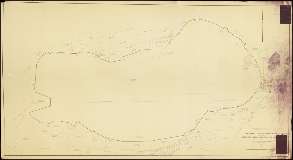
While we are no strangers to digitizing large objects here at DigitalNC, our newest partner, the Hyde County Historical and Genealogical Society, gave us quite the scanning challenge with their 1934 Mattamuskeet Lake Migratory Bird Refuge Grant Map! Measuring in at 6ft 4in by 3ft 9in, the map was over a foot longer than our largest scanning table. Since it was impossible for us to scan the whole map in one shot, we had to utilize our Phase One camera and its removable table top to scan the map in parts using a horizontal scrolling type technique.
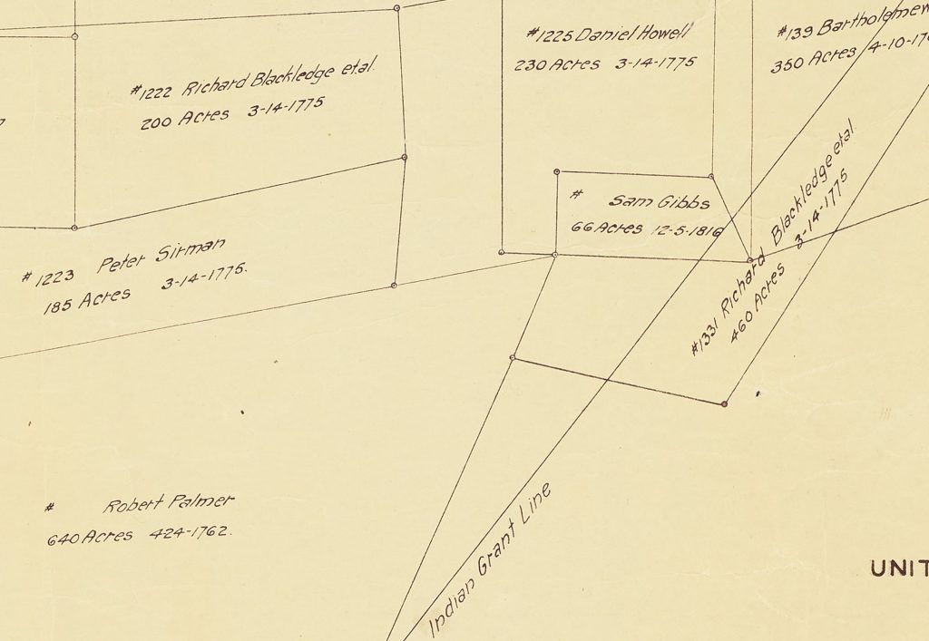
A portion of the map was set up on the table top with small weights carefully applied to hold the map in place and edges down while library carts and people supported the parts of the map off the table. Once a portion was scanned, the weights would be removed, the map shifted for the next portion (with overlap), and weights reapplied. This process was repeated over 30 times. Afterwards, the scanned images were pieced together to create an impressive full digital image of the map which shows the boundary of the lake and parcels of land along with individual parcel owner names, dates the land was acquired, and parcel acreage. A more detailed version of the map can be viewed here on DigitalNC.
Lake Mattamuskeet is recognized as North Carolina’s largest natural freshwater lake—stretching 18 miles long, seven miles wide, and averaging only two to three feet deep. While the lake may be shallow, its history is certainly not. The following paragraphs provide some information about the lake’s ancient and more recent past, but detailing its full history is beyond the scope of this blog post. If you are interested in learning more, please visit the resources that are linked at the end of this post.
At least 800 years before England’s 1584 expedition arrived at Roanoke Island, the coastal region of the state was occupied by several small Native American tribes, including the Algonquian-speaking Machapunga (also known as the Mattamuskeet or Marimiskeet American Indians). The Machapunga were a small tribe of the Algonquin language living in the Pungo River area who migrated south from the Algonquin peoples of the Powhatan Confederacy.
At that time, the Mattamuskeet were known as skillful watermen who made their boats and nets of size interlocks for herring, drum, shad, netting needles, and floats. In addition to their work on the water, they hunted; trapped; gathered berries, nuts, and fruit; and farmed. They grew plants such as corn, beans, pumpkins, goosefoot, sunflowers, knotweed, and squash. The women of the Machapunga are specifically noted as being fierce warriors. Today, the genealogical descendants from the original historic Mattamuskeet Indians of Hyde County, along with the original historic Roanoke-Hatteras (Croatan) Indians of Dare County comprise the Alogonquian Indians of North Carolina.
In 1934, the Mattamuskeet Lake Migratory Bird Refuge Grant Map was created—showing parcel boundaries along with providing the name of the parcel’s owner, the acreage, and the date it was acquired. Some names present on the map, such as Collins, Barber, Chance, Clayton, and Bryant, can trace their American Indian heritage back to the Mattamuskeet. The same year the map was published, the lake was acquired by the United States Government and the Mattamuskeet National Wildlife Refuge was established. This was likely a result of Roosevelt’s New Deal policies that helped provide jobs and relief to citizens during the Great Depression. Today, the Mattamuskeet National Wildlife Refuge (which includes the lake and surrounding area) remains federally protected and supports “large numbers of wintering waterfowl, as well as a variety of breeding songbirds, mammals such as black bear and bobcat, and other wildlife.”
To learn more about the Hyde County Historical and Genealogical Society, please visit their website linked here.
To view more maps of North Carolina on DigitalNC, click the following link.
This blog is maintained by the staff of the North Carolina Digital Heritage Center and features the latest news and highlights from the collections at DigitalNC, an online library of primary sources from organizations across North Carolina.


![Map title and associated information. United States Department of Agriculture Bureau of Biologial Survey. Jay. N. Darling. Chief.
Mattamuskeet Lake Migratory Bird Refuge Grant Map.
New Holland Corporation Tr[?].
(3)
Hyde County. North Carolina.
R.C.F. Surveyor.
1934.
Scale 1:15,840
[Bar for scale]](https://www.digitalnc.org/wp-content/uploads/2023/11/default-1-1-1024x623.jpg)