Viewing entries tagged "maps"

Detailed 1904 map of Anson County now online from new partner, Anson County Historical Society

anson

DigitalNC is happy to welcome a new partner– the Anson County Historical Society!

The Anson County Historical society is an organization devoted to providing access to Anson County’s rich history through educational, cultural, and recreational resources. This includes the preservation of physical items, like this map from 1904. An excellent resource for genealogists or local historians, this map documents family names and property locations in addition the other intricate details, like schools, cemeteries, businesses, railroads, and homesteads. Maps with this much detail are rare and serve as excellent research tools.

For more information about the Anson County Historical Society, please visit the contributor page or the website. For maps of North Carolina on DigitalNC, please search the Images of North Carolina Collection and limit by “maps.”


Hand-Drawn Maps Featured in New Hays Scrapbooks

Granville_Hays_Vol_91_0308

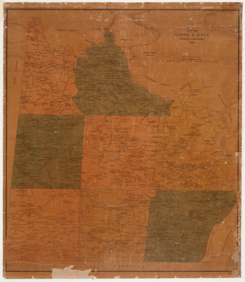
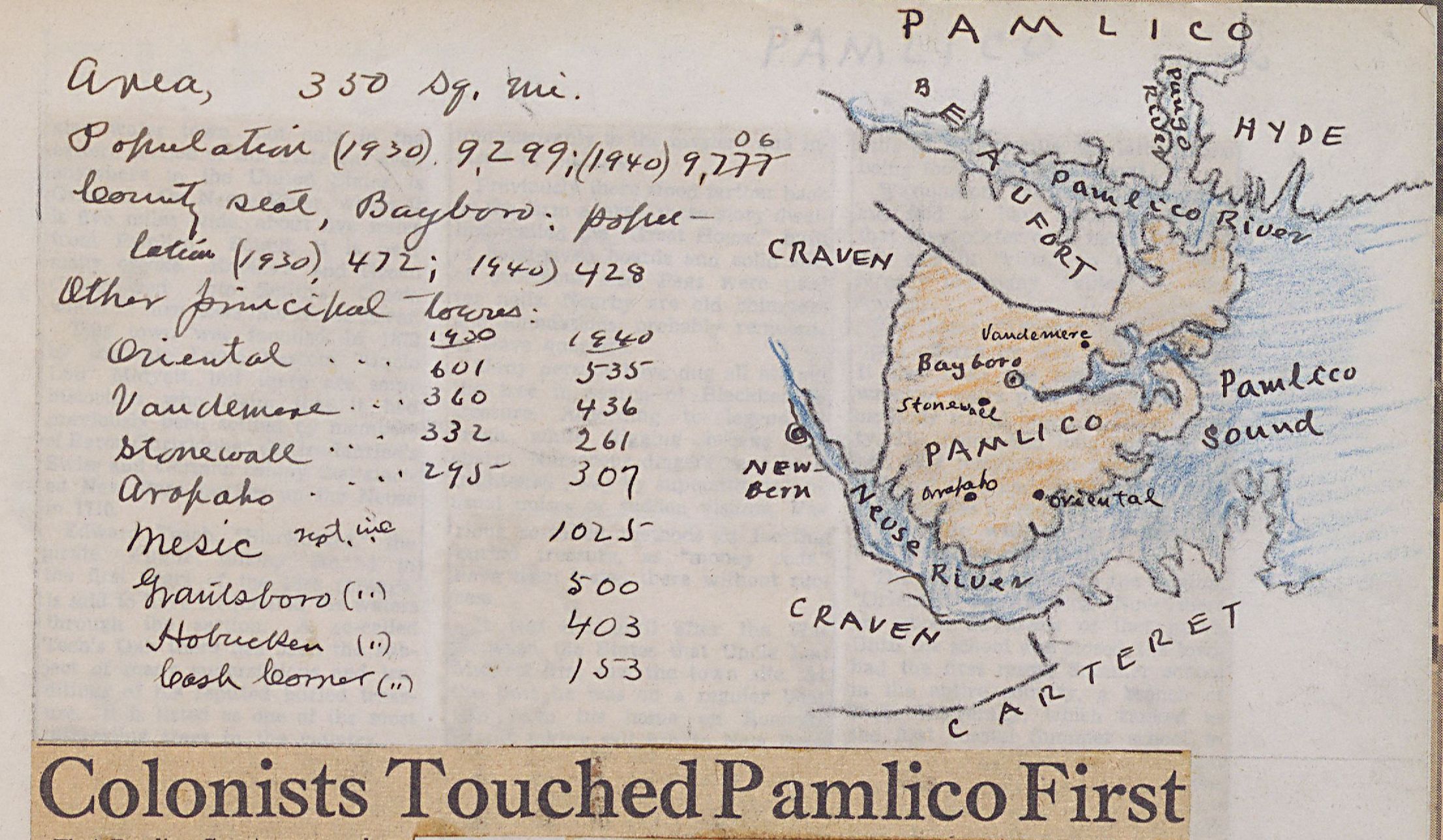
Map of Pamlico County from Francis B. Hays North Carolina Counties Scrapbook, Volume 4, Page 308

The above map of Pamlico County is one example of the many maps that Francis B. Hays created in his County Scrapbooks, among the newest volumes digitized from Granville County Public Library’s Hays collection. Hays drew a map for each of North Carolina’s 100 counties. The scrapbooks also include population data, historical information, and numerous stories and articles about famous people or events from the county. Hays dedicated a volume specifically to Vance County, Granville County’s next door neighbor.

Granville_Hays_Vol_93_0163

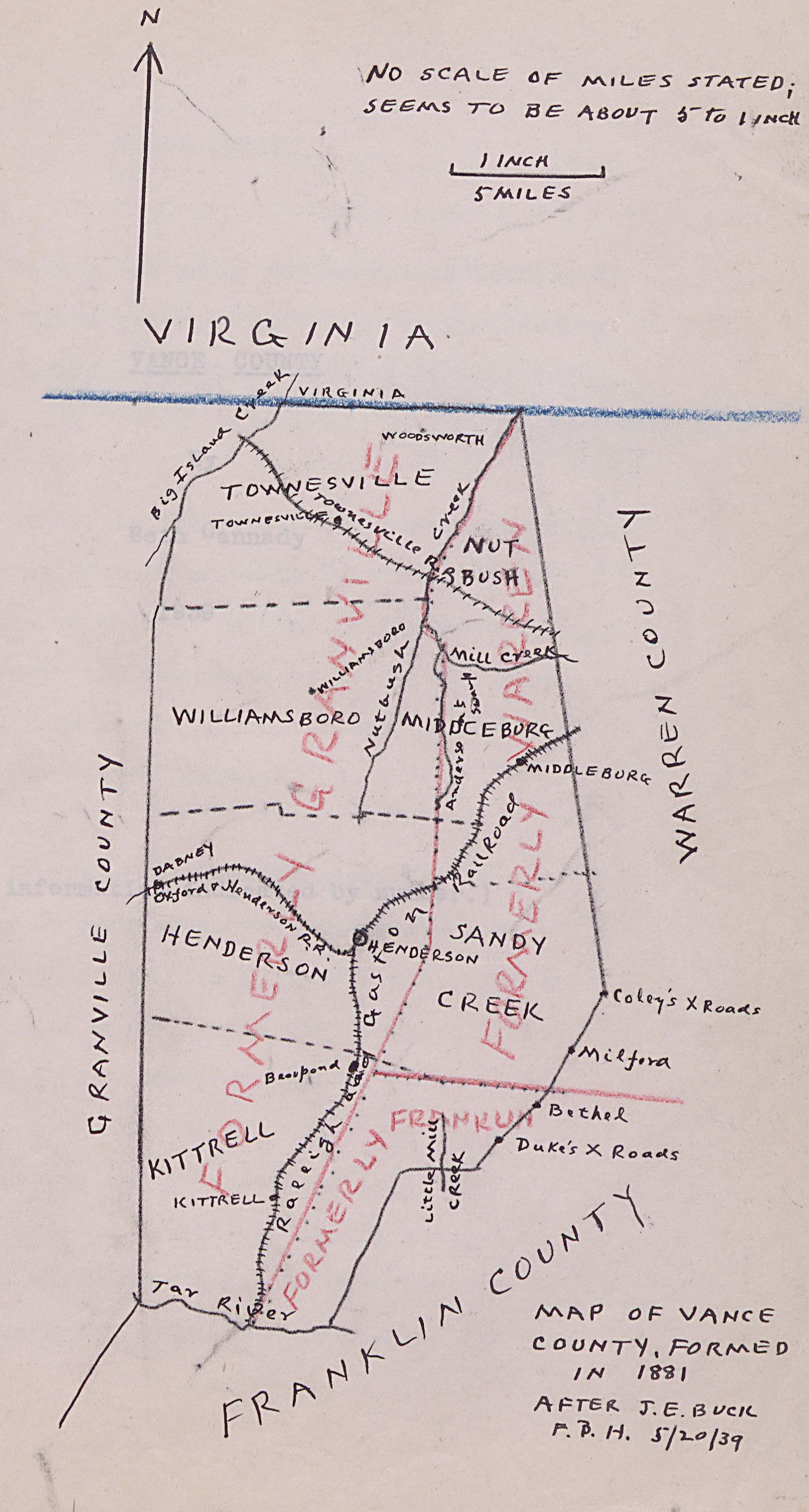
Map of Vance County from Francis B. Hays scrapbook of Vance County, Page 163

The county scrapbooks are part of a batch of fourteen added to the Francis B. Hays Collection. Mr. Hays was an educator and clerk in Granville County, who dedicated much of his time to documenting the county’s history. These scrapbooks represent Volumes 80-93 of 150 housed at the Granville County Public Library.

Aside from the County Volumes, Hays also documented doctors, nurses, and public health in Granville County, indexing names of those working in medical professions. These volumes could be useful for those interested in genealogical research in Granville County and the surrounding areas.

This batch also includes two other series of volumes: North Carolina Historical Items and Distinguished North Carolinians. The NC Historical Items series features many articles and clippings that discuss NC during and after the reconstruction era and during the colonial period with information about Native Americans who lived in the state or were removed by the government. The Distinguished North Carolinians series contains articles, clippings, and obituaries of noteworthy men and women connected to the state. Volume 3 of the series may be of particular interest because it contains the most information about noteworthy women, especially authors and poets.


granville_hays_vol92_0039

Cover the 1938 North Carolina Highways road map from Francis B. Hays’ scrapbook of North Carolina Maps and Miscellaneous, Page 39

You can see all of the recently added scrapbooks at the links below:

You can view all 93 digitized volumes at the Francis B. Hays Collection exhibit page. To learn more about the Granville County Public Library visit their contributor page or the website.


Maps, Panoramic Photos, and additional High School Papers from the Stanly County Museum

Maps_002

Map of Stanly County, published by Brevard Garrison Motor Company

We’ve added new items from the Stanly Count Museum to DigitalNC.

The latest additions to the Images of North Carolina Collection document several different decades of development in Stanly County.

Agriculture, especially cotton, was the primary economic source for the Ablemarle area during the early twentieth century. Wiscassett Mill is one of the oldest cotton and textile mills in the area, and employed many people from Stanly county. The large, panoramic images feature several of the mill’s buildings and some of the employees who kept the operation running.

Three of the four maps document new housing developments planned for the growing area during the late 1930s. The Map of Whispering Pines and Map of Forest Hills are good examples of middle class planned communities that were popping up throughout North Carolina during this period. Forest Hills was Stanly County’s first residential subdivision of this kind. The Map Showing Redivision and Additions Etc. to Forest Hills shows the growth and success of the community after only a short twelve years.

All of these images document the growth of Stanly County, especially in Albemarle, during the first half of the twentieth century. They could be of interest to anyone researching city planning and residential developments or those interested in the economic history of textiles in Stanly County and North Carolina.

In addition, the Museum was able to fill in some missing issues of The Full Moon, Albemarle High School’s student newspaper. This includes an early issue from 1929, which appears to simply be an invitation to a mock wedding upon graduation or some sort of inside joke (of which there are always many in student newspapers.

You can access all of the recent additions from the Stanly County Museum at the links below:

Here are the new issues of The Full Moon:

To see more from the Stanly County Museum, check out their contributor page or visit the website.


View Anson County Property Maps and Anson Technical Institute Yearbook Online

Educational robot from Anson Technical College's 1984 yearbook.

Educational robot from Anson Technical College’s 1984 yearbook.

The Digital Heritage Center recently uploaded a sole (but wonderful) yearbook from Anson Technical College, now South Piedmont Community College. This 1984 volume contains informative photographs of the students and community, as well as description of the programs and specialties offered. It even includes a full-page photograph of the school’s HERO robot (which stands for Heathkit Educational RObot).

Additional maps or plats surveyed and drawn by Frank S. Clarke were also added, joining those already online. These recent additions depict properties in and around Lilesville, a town near Wadesboro in Anson County.

To view all items from South Piedmont Community College, click here.


More Anson County Town and Property Maps Available on DigitalNC

spcc_TC_Coxe_Farms

T.C. Coxe Farms – September 30, 1947

In October 2014, we published 48 maps from the 1940s through the early 1970s that are held by the library at South Piedmont Community College in Polkton, N.C.

We have now added 30 more maps from the same date range. As before, the majority of the maps detail the boundaries of specific properties, including factories, churches, cemeteries, and farms.

These maps join the over 150 maps available from various institutions on DigitalNC.


Anson County Town and Property Maps Now Available on DigitalNC

Detail from a 1961 map of downtown Wadesboro, N.C.

Detail from a 1961 map of downtown Wadesboro, N.C.

We’ve recently finished work on group of mid 20th-century town and property maps from Anson County. The maps are held by the library at South Piedmont Community College in Polkton, N.C.

There are 48 maps now available online, ranging in date from the 1940s through the early 1970s. A few of the maps show the town of Wadesboro, but the majority detail the boundaries of specific properties, including factories, churches, cemeteries, and schools.


DigitalNC Blog Header Image

About

This blog is maintained by the staff of the North Carolina Digital Heritage Center and features the latest news and highlights from the collections at DigitalNC, an online library of primary sources from organizations across North Carolina.

Social Media Policy

Search the Blog

Archives

Subscribe

Email subscribers can choose to receive a daily, weekly, or monthly email digest of news and features from the blog.

Newsletter Frequency
RSS Feed